IMAGES TAKEN NEAR TO
Great Lime Road, NEWCASTLE UPON TYNE, NE12 9DH
Introduction
This page details the photographs taken nearby to Great Lime Road, NE12 9DH by members of the Geograph project.
The Geograph project started in 2005 with the aim of publishing, organising and preserving representative images for every square kilometre of Great Britain, Ireland and the Isle of Man.

There are currently over 7.5m images from over14,400 individuals and you can help contribute to the project by visiting https://www.geograph.org.uk
Image Map (Loading...)


Getting Data...Please wait
Leaflet Map data © OpenStreetMap
Images are licensed for reuse under creativecommons.org/licenses/by-sa/2.0
Notes
- Clicking on the map will re-center to the selected point.
- The higher the marker number, the further away the image location is from the centre of the postcode.
Image Listing (34 Images Found)
Images are licensed for reuse under creativecommons.org/licenses/by-sa/2.0
Image
Details
Distance

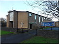
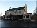
3
Forest Hall Social Club, Great Lime Road.
Image: © Bill Henderson
Taken: 9 Mar 2007
0.06 miles
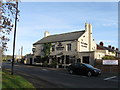
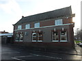
7
Entrance to the Old Killingworth Waggonway footpath, Palmersville
Image: © Bill Henderson
Taken: 4 Sep 2013
0.12 miles
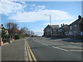
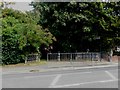
8
'Waggonways' Signage, Great Lime Road near Palmersville
This signage marks the southern end of a public footpath which follows the route of the old Killingworth Waggonway. The waggonway was opened in 1764 and ran from Killingworth Colliery to Willington Quay. The North Tyneside historic network of waggonways had fallen into disrepair over many years but in 2000 North Tyneside Council successfully bid for over £2 million worth of Government funding to transform more than 30 miles of these waggonways into recreational routes for walkers and cyclists. You can see similar waggonway signage dotted about North Tyneside https://www.geograph.org.uk/photo/6564101. For a selection of detailed free to download walking routes in the area visit www.northtynesidewalks.co.uk
Image: © Geoff Holland
Taken: 1 Dec 2020
0.12 miles
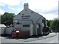
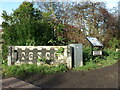
9
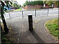
The Exit from the Killingworth Old Waggonway on to Great Lime Road, Palmersville
The bollard at the end of the Old Waggonway Path is in the form of a miners lamp.
Image: © Bill Henderson
Taken: 4 Sep 2013
0.12 miles