
IMAGES TAKEN NEAR TO
Whitfield Drive, NEWCASTLE UPON TYNE, NE12 8LD
Introduction
This page details the photographs taken nearby to Whitfield Drive, NE12 8LD by members of the Geograph project.
The Geograph project started in 2005 with the aim of publishing, organising and preserving representative images for every square kilometre of Great Britain, Ireland and the Isle of Man.

There are currently over 7.5m images from over14,400 individuals and you can help contribute to the project by visiting https://www.geograph.org.uk
Image Map
Images are licensed for reuse under creativecommons.org/licenses/by-sa/2.0
Notes
- Clicking on the map will re-center to the selected point.
- The higher the marker number, the further away the image location is from the centre of the postcode.
Image Listing (58 Images Found)
Images are licensed for reuse under creativecommons.org/licenses/by-sa/2.0
Image
Details
Distance
1
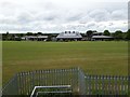
School playing field, Longbenton
The playing field shared by St Bartholomew's and St Stephen's primary schools in Longbenton.
Image: © Graham Robson
Taken: 18 May 2020
0.09 miles
2
Eastfield Road, Longbenton
A residential street in Longbenton.
Image: © Graham Robson
Taken: 18 May 2020
0.11 miles
3
Goathland Avenue, Longbenton
A residential street in Longbenton.
Image: © Graham Robson
Taken: 18 May 2020
0.13 miles
4
Carlton Road, Longbenton
A residential street in Longbenton with semi detached houses on either side.
Image: © Graham Robson
Taken: 18 May 2020
0.13 miles
5
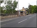
Bus shelter and disused toilets, Ashleigh Grove, Longbenton
A building containing a bus shelter and boarded up public toilets on Ashleigh Grove in Longbenton, beside the main entrance to Benton Cemetery.
Image: © Graham Robson
Taken: 18 May 2020
0.14 miles
6
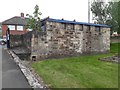
Disused toilets, Benton Cemetery
The building has the distinctive appearance of a disused toilet block and is located at the Ashleigh Grove entrance to Benton Cemetery.
Image: © Graham Robson
Taken: 18 May 2020
0.14 miles
7
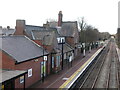
Benton Metro Station, Benton
This station, which forms part of the Tyne & Wear Metro System, was originally opened on 1st March 1871 and operated as part of the North Eastern Railway. The platform pictured is the western platform. For a selection of detailed free to download walking routes in the area visit www.northtynesidewalks.co.uk
Image: © Geoff Holland
Taken: 16 Mar 2021
0.15 miles
8
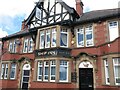
The Ship Inn, Front Street, Benton
There is a long history of a Ship Inn in the immediate area. This particular Ship Inn was built in 1904 and is a highly detailed building, with many of its design features, such as chimneys, rainwater goods and stonework, still intact. For a selection of detailed free to download walking routes in the area visit www.northtynesidewalks.co.uk
Image: © Geoff Holland
Taken: 16 Mar 2021
0.16 miles
9
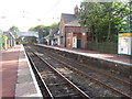
Benton Metro station, Tyne & Wear
Opened in 1871 by the Blyth & Tyne Railway on what later became the North Tyneside loop line from Newcastle to Tynemouth, this station was rebuilt and converted to Metro operation in 1980.
View east towards Forest Hall and Tynemouth.
Image: © Nigel Thompson
Taken: 17 Sep 2010
0.16 miles
10
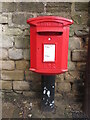
Post Box, Front Street, Benton
This pedestal post box, which dates from the reign of Queen Elizabeth II, stands next to the Ship Inn https://www.geograph.org.uk/photo/6779268. For a selection of detailed free to download walking routes in the area visit www.northtynesidewalks.co.uk
Image: © Geoff Holland
Taken: 16 Mar 2021
0.16 miles