
IMAGES TAKEN NEAR TO
High Street, GATESHEAD, NE10 9LT
Introduction
This page details the photographs taken nearby to High Street, NE10 9LT by members of the Geograph project.
The Geograph project started in 2005 with the aim of publishing, organising and preserving representative images for every square kilometre of Great Britain, Ireland and the Isle of Man.

There are currently over 7.5m images from over14,400 individuals and you can help contribute to the project by visiting https://www.geograph.org.uk
Image Map
Images are licensed for reuse under creativecommons.org/licenses/by-sa/2.0
Notes
- Clicking on the map will re-center to the selected point.
- The higher the marker number, the further away the image location is from the centre of the postcode.
Image Listing (73 Images Found)
Images are licensed for reuse under creativecommons.org/licenses/by-sa/2.0
Image
Details
Distance
1
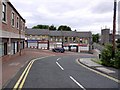
Wellington Street, Felling
The shops are at the bottom of High Street.
Image: © Andrew Curtis
Taken: 16 Jul 2010
0.01 miles
2
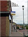
High Street, Felling
A wrought iron shop sign hints of different times. The sign used to sport three gold balls, denoting a pawnbrokers shop, owned here by John M. Costelloe in 1907 http://www.gateshead-history.com/felling.html
Image: © Andrew Curtis
Taken: 16 Jul 2010
0.02 miles
4
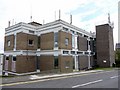
Telephone Exchange, Wellington Street, Felling
For another photo see Image
Image: © Andrew Curtis
Taken: 16 Jul 2010
0.04 miles
5
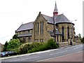
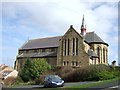
St Patrick's Roman Catholic Church, Felling
View from Wellington Street. Another here Image
St Patrick's RC Church, built by Charles Walker of Newcastle in 1893-5, opened on St Patrick's Day, 17th March 1895 replacing the original church on Felling Shore http://www.gateshead-history.com/felling.html
Image: © Andrew Curtis
Taken: 16 Jul 2010
0.04 miles
6
Davidson Street, Felling
Looking down towards the junction with St John's Place and Image
Image: © Andrew Curtis
Taken: 16 Jul 2010
0.06 miles
7
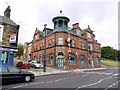
Former pub on corner of High Street and Sunderland Road, Felling
This was the Bee's Wing Hotel, named after a race horse who won the Newcastle Gold Cup 6 times, the Doncaster Gold Cup 4 times and the Ascot Gold Cup in 1842. She was nicknamed 'the miner's friend'.
Later it became an Irish Pub called 'Durty Nelly's' and is now used for temporary accommodation http://www.gateshead-history.com/felling.html
Image: © Andrew Curtis
Taken: 16 Jul 2010
0.06 miles
8
Wesley Court, Wellington Street, Felling
Image: © Andrew Curtis
Taken: 16 Jul 2010
0.07 miles
9
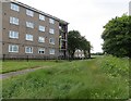
Flats off Felling Gate
On the side of a steep slope descending Gateshead Fell.
Image: © Richard Webb
Taken: 18 Jun 2013
0.07 miles
10
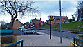
Sunderland Road, Felling
View from the Metro Station foot bridge.
Image: © wfmillar
Taken: 3 Jan 2014
0.07 miles