IMAGES TAKEN NEAR TO
St. Johns Place, GATESHEAD, NE10 9DF
Introduction
This page details the photographs taken nearby to St. Johns Place, NE10 9DF by members of the Geograph project.
The Geograph project started in 2005 with the aim of publishing, organising and preserving representative images for every square kilometre of Great Britain, Ireland and the Isle of Man.

There are currently over 7.5m images from over14,400 individuals and you can help contribute to the project by visiting https://www.geograph.org.uk
Image Map
Images are licensed for reuse under creativecommons.org/licenses/by-sa/2.0
Notes
- Clicking on the map will re-center to the selected point.
- The higher the marker number, the further away the image location is from the centre of the postcode.
Image Listing (72 Images Found)
Images are licensed for reuse under creativecommons.org/licenses/by-sa/2.0
Image
Details
Distance
1
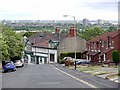
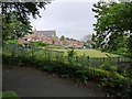
View from St John's Lane, Felling
The building below is Image
Image: © Andrew Curtis
Taken: 16 Jul 2010
0.02 miles
2
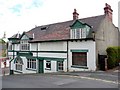
The Green Mandolin, St Johns Lane, Felling
Image: © Andrew Curtis
Taken: 16 Jul 2010
0.02 miles
3
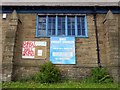
Christ Church Hall, Sunderland Road, Felling
Built as a Church Hall for Christ Church Image in 1894 but reinvented as a Community Centre as 'The House on the Hill' from 1997. Its history is here http://www.christchurchfelling.org/
Image: © Andrew Curtis
Taken: 16 Jul 2010
0.03 miles
5
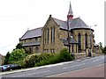
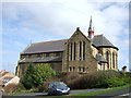
St Patrick's Roman Catholic Church, Felling
View from Wellington Street. Another here Image
St Patrick's RC Church, built by Charles Walker of Newcastle in 1893-5, opened on St Patrick's Day, 17th March 1895 replacing the original church on Felling Shore http://www.gateshead-history.com/felling.html
Image: © Andrew Curtis
Taken: 16 Jul 2010
0.04 miles
7
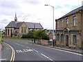
Davidson Street, Felling
Looking down towards the junction with St John's Place and Image
Image: © Andrew Curtis
Taken: 16 Jul 2010
0.05 miles
8
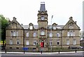
Felling Council Offices, Sunderland Road
Built in 1902 for Felling Urban District Council at the same time as the Police Station on the opposite side of the road. The crest above the door of a sturdy oak branch was adopted by the Council from that of the local Brandling family. The District Council was merged into Gateshead in 1974. The building is now used for temporary accommodation http://www.gateshead-history.com/felling.html
Image: © Andrew Curtis
Taken: 16 Jul 2010
0.05 miles
9
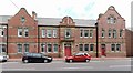
Former Police Station, Sunderland Road, Felling
Now houses offices of Gateshead's Youth Offending Team.
Image: © Andrew Curtis
Taken: 16 Jul 2010
0.05 miles