
IMAGES TAKEN NEAR TO
Udston Mill Road, LARKHALL, ML9 3FL
Introduction
This page details the photographs taken nearby to Udston Mill Road, ML9 3FL by members of the Geograph project.
The Geograph project started in 2005 with the aim of publishing, organising and preserving representative images for every square kilometre of Great Britain, Ireland and the Isle of Man.

There are currently over 7.5m images from over14,400 individuals and you can help contribute to the project by visiting https://www.geograph.org.uk
Image Map
Images are licensed for reuse under creativecommons.org/licenses/by-sa/2.0
Notes
- Clicking on the map will re-center to the selected point.
- The higher the marker number, the further away the image location is from the centre of the postcode.
Image Listing (8 Images Found)
Images are licensed for reuse under creativecommons.org/licenses/by-sa/2.0
Image
Details
Distance
1
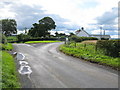
Udston
Minor road junction to the south of Stonehouse.
Image: © G Laird
Taken: 27 Aug 2010
0.06 miles

3
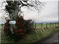
High Lanrig farm sign
An old sign incorporated into a tree at the road-end of High Lanrig.
Image: © Alan O'Dowd
Taken: 5 Jan 2020
0.07 miles
4
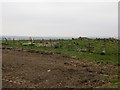
Rickle of stones, Udston
Early 20th century maps show a building on this hilltop, at a meeting of two strip woods. The woods have gone too.
Image: © Richard Webb
Taken: 21 Apr 2014
0.09 miles
5

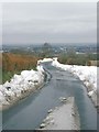
Radio mast at Udston
Big drifts of snow still lying after the 6 to 8 inch falls 3 days ago.
Image: © Gordon Brown
Taken: 14 Mar 2006
0.12 miles
7

Derelict Glenburn Cottage near Udston, Stonehouse
Possibly connected to the adjacent Glenburn Brick and Tile works which is marked on the 1855 map. The works mainly produced roofing tiles and drainage tiles and was still in business in 1870. On the 1896 map the works have gone but the cottage looks like it has been occupied until fairly recent times.
Image: © wrobison
Taken: 21 Apr 2021
0.21 miles
8

Field of cut grass near Udston
Tinto hill is in the distance
Image: © wrobison
Taken: 12 Jun 2012
0.24 miles