
IMAGES TAKEN NEAR TO
St. Lukes Avenue, CARLUKE, ML8 5TE
Introduction
This page details the photographs taken nearby to St. Lukes Avenue, ML8 5TE by members of the Geograph project.
The Geograph project started in 2005 with the aim of publishing, organising and preserving representative images for every square kilometre of Great Britain, Ireland and the Isle of Man.

There are currently over 7.5m images from over14,400 individuals and you can help contribute to the project by visiting https://www.geograph.org.uk
Image Map
Images are licensed for reuse under creativecommons.org/licenses/by-sa/2.0
Notes
- Clicking on the map will re-center to the selected point.
- The higher the marker number, the further away the image location is from the centre of the postcode.
Image Listing (13 Images Found)
Images are licensed for reuse under creativecommons.org/licenses/by-sa/2.0
Image
Details
Distance
1
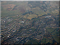
Carluke from the air
Lanark Road at Wilton Road is in the foreground, the John Cumming Stadium is in the distance.
Image: © Thomas Nugent
Taken: 8 Dec 2017
0.09 miles
2
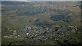
Carluke from the air
With Black Law wind farm in the distance
Image: © Thomas Nugent
Taken: 19 Dec 2024
0.11 miles
3

Milton Road
A road on the edge of Carluke. The maps have recently lost the yellow colour and it has probably been blocked off at the eastern end on the busy Lanark Road.
Image: © Richard Webb
Taken: 11 Nov 2011
0.12 miles
4
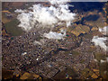
Carluke from the air
The tree-lined Jock's Burn http://www.clydeandavonvalley.org/news-hub/item/jock-s-burn-in-carluke can be seen running through the town.
Image: © Thomas Nugent
Taken: 19 Mar 2018
0.12 miles
5
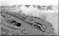
Carluke, 1961: Stanier 'Coronation' 4-6-2 on Up WCML express
View northward at the Milton Road bridge, towards Glasgow, Stirling and Perth on the ex-Caledonian Railway WCML. The 12.00 Perth - London Euston is headed by the last 'Princess-Coronation' Class 8P 4-6-2 to be built (5/48) No. 46257 'City of Salford', like No. 46256 an Ivatt-modified variety with roller-bearings, however it only survived until 10/64.
Image: © Ben Brooksbank
Taken: 6 Oct 1961
0.14 miles
6
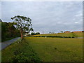
South Hillhead, Carluke
Horses grazing fields on the outskirts of Carluke, with the chimney of the Mayfield brickworks in the background.
Image: © Alan O'Dowd
Taken: 20 Jun 2012
0.14 miles
7

Glasgow main line
Looking north at Carluke.
Image: © Jonathan Billinger
Taken: 17 Jul 2007
0.15 miles
8
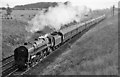
Manchester - Glasgow express approaching Carluke
View southward, towards Carstairs; ex-Caledonian West Coast Main Line, (London, Crewe etc.) - Carlisle - Carstairs - Glasgow Central. The train is headed by a BR Standard Class 6 4-6-2, No. 72000 'Clan Buchanan' - a Class that was largely confined to the Scottish Region.
Image: © Ben Brooksbank
Taken: 6 Oct 1961
0.16 miles

10
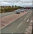
Car Park:Tesco Carluke
Supermarket built at Loch Park stadium which was home to Carluke Rovers FC
Image: © Jim Smillie
Taken: 14 May 2021
0.19 miles