
IMAGES TAKEN NEAR TO
Station Road, CARLUKE, ML8 5PS
Introduction
This page details the photographs taken nearby to Station Road, ML8 5PS by members of the Geograph project.
The Geograph project started in 2005 with the aim of publishing, organising and preserving representative images for every square kilometre of Great Britain, Ireland and the Isle of Man.

There are currently over 7.5m images from over14,400 individuals and you can help contribute to the project by visiting https://www.geograph.org.uk
Image Map
Images are licensed for reuse under creativecommons.org/licenses/by-sa/2.0
Notes
- Clicking on the map will re-center to the selected point.
- The higher the marker number, the further away the image location is from the centre of the postcode.
Image Listing (24 Images Found)
Images are licensed for reuse under creativecommons.org/licenses/by-sa/2.0
Image
Details
Distance
1
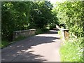
Bridge over Jock's Burn
In this view, a stone panel can be seen, built into the wall of the bridge on its left-hand side; unfortunately, the lettering of its inscription was so worn as to be unreadable.
Image: © Lairich Rig
Taken: 1 Jul 2005
0.07 miles
2
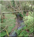
Jock's Burn
From the bridge on Station Road
Image: © Jim Smillie
Taken: 14 May 2021
0.08 miles
3
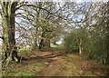
Path near Glenburn, Carluke
A path towards the golf course from the Jock's Gill woods.
Image: © Alan O'Dowd
Taken: 5 Apr 2020
0.11 miles
4
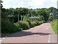
Station Road, Carluke
The photo was taken from just in front of Image, but it is a view in the opposite direction.
The structure on the left-hand side of the road is an electricity sub-station.
Image: © Lairich Rig
Taken: 1 Jul 2005
0.13 miles
5
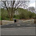
Nature reserve entrance
Series of paths in former clay pit
Image: © Jim Smillie
Taken: 14 May 2021
0.15 miles
6
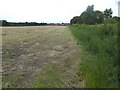
Hayfield near Under Shieldhill
The farm can be seen at the end of the sight-line of the hedge.
Image: © Jonathan Billinger
Taken: 17 Jul 2007
0.17 miles
7
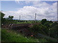
Railway Bridge at Carluke
A minor road goes under the London-Glasgow line. This is taken from the edge of Carluke Station Car Park, looking NW towards Law Hill.
Image: © Jennifer Romero
Taken: 27 Jun 2005
0.19 miles
8
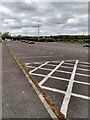
Plenty of spaces available
Park and ride at Carluke station
Image: © Jim Smillie
Taken: 14 May 2021
0.19 miles
9

Carluke Park & Ride
This large car park is located next to Carluke Station with easy pedestrian access.
Image: © Mary and Angus Hogg
Taken: 21 Sep 2011
0.19 miles
10
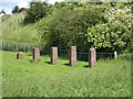
Possible remains of aqueduct
These small brick columns are located near the corner of a field, a short distance to the west of the railway bridge: Image They are about 65 metres from Station Road (the photo was taken from the roadside). The embankment visible in the background is that of the railway line.
I did not find any archaeological reports for this location, but the 1:10560 OS map of 1899 shows a fairly short aqueduct at this spot, running in the same direction as the line of columns (parallel to the railway line). It therefore seems likely that these columns are the remains of the small aqueduct. The date of its construction can be narrowed down a little: it is not shown on the equivalent OS map from 1864.
Image: © Lairich Rig
Taken: 1 Jul 2005
0.21 miles