
IMAGES TAKEN NEAR TO
Harestanes Industrial Estate, CARLUKE, ML8 5PP
Introduction
This page details the photographs taken nearby to Harestanes Industrial Estate, ML8 5PP by members of the Geograph project.
The Geograph project started in 2005 with the aim of publishing, organising and preserving representative images for every square kilometre of Great Britain, Ireland and the Isle of Man.

There are currently over 7.5m images from over14,400 individuals and you can help contribute to the project by visiting https://www.geograph.org.uk
Image Map
Images are licensed for reuse under creativecommons.org/licenses/by-sa/2.0
Notes
- Clicking on the map will re-center to the selected point.
- The higher the marker number, the further away the image location is from the centre of the postcode.
Image Listing (6 Images Found)
Images are licensed for reuse under creativecommons.org/licenses/by-sa/2.0
Image
Details
Distance
1
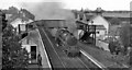
Braidwood Station, with train
View NW, towards Glasgow; ex-Caledonian Rly. West Coast Main Line, Glasgow (Central) - Carlisle. Station closed to passengers 2/7/62, goods 6/7/64. The train arriving is a Glasgow Central - Carlisle Slow, hauled by BR Standard Caprotti-fitted Class 5 4-6-0 No. 73154 (built 6/57, withdrawn 2/66).
Image: © Ben Brooksbank
Taken: 6 Oct 1961
0.02 miles
2
Junction of Braidwood Road and Lanark Road
Image: © Elliott Simpson
Taken: 7 Sep 2016
0.08 miles
3
The Station Inn near Braidwood
In South Lanarkshire.
Image: © James Denham
Taken: 23 Aug 2009
0.09 miles
4
Garden Centre/Restaurant
Closed in 2008 to make way for development.
Image: © Jim Smillie
Taken: Unknown
0.13 miles
5
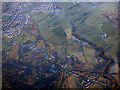
Braidwood and Carluke from the air
Roads and railway crossing at Braidwood, with Carluke in the left distance.
Image: © Thomas Nugent
Taken: 8 Dec 2017
0.16 miles
6
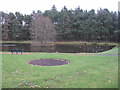
Pond in Braidwood
Just north of the B7056, Braidwood Road, when entering Braidwood from Crossford.
Image: © G Laird
Taken: 9 Dec 2013
0.24 miles