
IMAGES TAKEN NEAR TO
Avon Avenue, CARLUKE, ML8 5DD
Introduction
This page details the photographs taken nearby to Avon Avenue, ML8 5DD by members of the Geograph project.
The Geograph project started in 2005 with the aim of publishing, organising and preserving representative images for every square kilometre of Great Britain, Ireland and the Isle of Man.

There are currently over 7.5m images from over14,400 individuals and you can help contribute to the project by visiting https://www.geograph.org.uk
Image Map
Images are licensed for reuse under creativecommons.org/licenses/by-sa/2.0
Notes
- Clicking on the map will re-center to the selected point.
- The higher the marker number, the further away the image location is from the centre of the postcode.
Image Listing (7 Images Found)
Images are licensed for reuse under creativecommons.org/licenses/by-sa/2.0
Image
Details
Distance
1
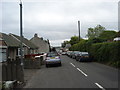
Kirk Road, Carluke
More of these wind turbines on the horizon. Virtually every grid square in this area has views of these monstrosities.
Image: © paul birrell
Taken: 11 Jun 2006
0.17 miles
2
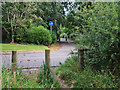
Footpath crossing Luggie Road, Carluke
On the route of the Old Wishaw Road from Law to Carluke.
Image: © wrobison
Taken: 6 Aug 2022
0.21 miles
3
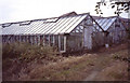
Tomato houses
Now part of a housing estate.
Image: © Jim Smillie
Taken: Unknown
0.21 miles
4
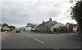
The A73 heading in to Carluke
In South Lanarkshire.
Image: © James Denham
Taken: 14 Sep 2013
0.22 miles
6
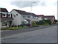
Moss-Side Avenue, Carluke
1970's housing on the outskirts of town.
Image: © Jonathan Billinger
Taken: 17 Jul 2007
0.23 miles
7
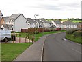
Maudslie Road
New houses on the edge of Carluke.
Image: © Richard Webb
Taken: 24 Sep 2010
0.23 miles