IMAGES TAKEN NEAR TO
Mill Road, CARLUKE, ML8 5AH

Introduction

This page details the photographs taken nearby to Mill Road, ML8 5AH by members of the Geograph project.

The Geograph project started in 2005 with the aim of publishing, organising and preserving representative images for every square kilometre of Great Britain, Ireland and the Isle of Man.

There are currently over 7.5m images from over14,400 individuals and you can help contribute to the project by visiting https://www.geograph.org.uk

Image Map


Images are licensed for reuse under creativecommons.org/licenses/by-sa/2.0
Notes
  • Clicking on the map will re-center to the selected point.
  • The higher the marker number, the further away the image location is from the centre of the postcode.

Image Listing (19 Images Found)

Images are licensed for reuse under creativecommons.org/licenses/by-sa/2.0
Image
Details
Distance
1
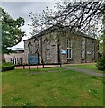
Kirkton parish church, Carluke
Nicely landscaped in grounds by Station Road.
Image: © Jonathan Billinger Taken: 17 Jul 2007
0.05 miles
2
Kirkton Church
There has been a church here since 1832
Image: © Jim Smillie Taken: 14 May 2021
0.08 miles
3
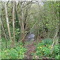
Jock's Burn
As it emerges from under Lanark Road
Image: © Jim Smillie Taken: 14 May 2021
0.16 miles
4
Green space in Carluke
View north of Station Road.
Image: © Jonathan Billinger Taken: 17 Jul 2007
0.17 miles
5
Carluke from the air
Looking along Market Road to Belstane Road.
Image: © Thomas Nugent Taken: 9 Feb 2018
0.18 miles
6
Sign for the Kirkton Inn
Sign for the inn found beside the A73, Kirkton Street.
Image: © Maigheach-gheal Taken: 5 Apr 2010
0.19 miles
7
Clothing recycling
Clothes bins in a corner of a car park, Carluke.
Image: © Richard Webb Taken: 24 Sep 2010
0.20 miles
8
Housing and Railway on south side of Carluke
Main west coast line can be seen in middle distance as well as 1950's local authority housing and 1970's private housing on edge of an expanding town in Lanarkshire
Image: © paul birrell Taken: 11 Jun 2006
0.21 miles
9
Kirkton Street, Carluke
Image: © Richard Webb Taken: 24 Sep 2010
0.22 miles
10
Carluke Town Centre
In common with many places now, this is predominantly a pedestrian precinct. Until the 1970's, this was the road to Carnwath and then on to Peebles. The church in the distance is the United Reformed Church.
Image: © G Laird Taken: 15 Mar 2009
0.22 miles