IMAGES TAKEN NEAR TO
Market Court, CARLUKE, ML8 4FB

Introduction

This page details the photographs taken nearby to Market Court, ML8 4FB by members of the Geograph project.

The Geograph project started in 2005 with the aim of publishing, organising and preserving representative images for every square kilometre of Great Britain, Ireland and the Isle of Man.

There are currently over 7.5m images from over14,400 individuals and you can help contribute to the project by visiting https://www.geograph.org.uk

Image Map


Images are licensed for reuse under creativecommons.org/licenses/by-sa/2.0
Notes
  • Clicking on the map will re-center to the selected point.
  • The higher the marker number, the further away the image location is from the centre of the postcode.

Image Listing (28 Images Found)

Images are licensed for reuse under creativecommons.org/licenses/by-sa/2.0
  • ...
Image
Details
Distance
1
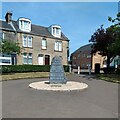
Memorial to military men of Carluke
Erected in 2000 by the Rotary to commemorate Carluke's 3 VC' and General Roy. A plaque for the town's most decorated soldier lies in front.
Image: © Jim Smillie Taken: 23 Jul 2021
0.05 miles
2
Market Place Carluke
Relatively unchanged
Image: © Jim Smillie Taken: Unknown
0.05 miles
3
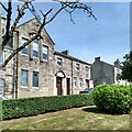
Lodge St John Carluke No 187
Masonic lodge first established in 1794
Image: © Jim Smillie Taken: 23 Jul 2021
0.06 miles
4
Windsor Cinema
Extravagant facade and a well known landmark, now long gone.
Image: © Jim Smillie Taken: Unknown
0.08 miles
5
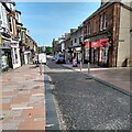
High Street Carluke 2021
Contrast with 1986 photo Image
Image: © Jim Smillie Taken: 23 Jul 2021
0.08 miles
6
War Memorial and gardens at Carluke
Image: © James Denham Taken: 23 Aug 2009
0.08 miles
7
Kirkton Street, Carluke
Image: © Richard Webb Taken: 24 Sep 2010
0.08 miles
8
The main road heading towards Carluke town centre
Image: © James Denham Taken: 23 Aug 2009
0.09 miles
9
The Kirkton Inn, Carluke
The inn has recently been refurbished. It is on 10 Kirkton Street. For a view of the sign Image
Image: © Maigheach-gheal Taken: 5 Apr 2010
0.09 miles
10
Carluke Town Centre
In common with many places now, this is predominantly a pedestrian precinct. Until the 1970's, this was the road to Carnwath and then on to Peebles. The church in the distance is the United Reformed Church.
Image: © G Laird Taken: 15 Mar 2009
0.09 miles
  • ...