
IMAGES TAKEN NEAR TO
Miller Street, CARLUKE, ML8 4DN
Introduction
This page details the photographs taken nearby to Miller Street, ML8 4DN by members of the Geograph project.
The Geograph project started in 2005 with the aim of publishing, organising and preserving representative images for every square kilometre of Great Britain, Ireland and the Isle of Man.

There are currently over 7.5m images from over14,400 individuals and you can help contribute to the project by visiting https://www.geograph.org.uk
Image Map
Images are licensed for reuse under creativecommons.org/licenses/by-sa/2.0
Notes
- Clicking on the map will re-center to the selected point.
- The higher the marker number, the further away the image location is from the centre of the postcode.
Image Listing (11 Images Found)
Images are licensed for reuse under creativecommons.org/licenses/by-sa/2.0
Image
Details
Distance
1
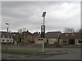
Solar powered flashers
A residential area of Carluke, near the school, with "flashing nanny" signs. These are powered by solar panels held high above easy ned access height. They would have been struggling to power up on this dark day.
Image: © Richard Webb
Taken: 29 Mar 2008
0.12 miles
2
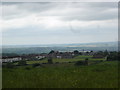
Moor Park ,Carluke from Yieldshields Road
Playing fields and housing on eastern edge of town
Image: © paul birrell
Taken: 11 Jun 2006
0.12 miles
3
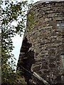
Highmill Windmill
This once industrious mill is about to fall if action isn't taken soon to repair it.
Image: © Digitalbabe
Taken: 18 Aug 2011
0.16 miles
4
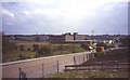
Carluke High School
Opened in the 1970's, these buildings were demolished in spring 2008 after the new school opened.
The new school occupies the land immediately to the east.
Image: © Jim Smillie
Taken: Unknown
0.19 miles
5
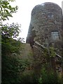
The High Mill
Built in 1797, the High Mill of Carluke is the most complete Scottish windmill.
The mill was powered by wind for approx 50 years then
converted to steam. It was working until the 1930s but is now in a state of collapse despite being an A listed building.
Image: © Jim Ness
Taken: 20 Jul 2009
0.19 miles
6
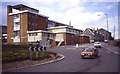
High Mill / Victoria Park
A primary school and a special needs school which occupy the buildings of the first Carluke High School
Image: © Jim Smillie
Taken: Unknown
0.21 miles
7
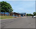
Carluke Leisure Centre
Previously shared with Carluke High School PE and Drama departments
Image: © Jim Smillie
Taken: 23 Jul 2021
0.21 miles
8

United Reformed Church: Carluke
Just off roundabout on Carnwath Road
Image: © Jim Smillie
Taken: 23 Jul 2021
0.22 miles
9
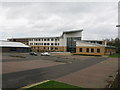
Carluke High School
A new school building, opened in November 2007, which has been constructed on the site of the former playing fields.
Image: © G Laird
Taken: 28 Oct 2011
0.23 miles
10

St.Luke's Graveyard, Belfry and ruins of Church
Carluke parish church, which belonged to Lesmahagow Priory, was dedicated to St Andrew, but there was an earlier dedication to St Luag or Maluag. Fragments remain of the 14th or 15th c church, which measured 90' x 24'. In ruins by 1650, it was repaired, and a belfry added in 1715. This church was replaced in 1799 by the present parish church, and was dismantled early in the 19th century.
Image: © Digitalbabe
Taken: 2 Jul 2011
0.24 miles