IMAGES TAKEN NEAR TO
Park Street, CARLUKE, ML8 4BF
Introduction
This page details the photographs taken nearby to Park Street, ML8 4BF by members of the Geograph project.
The Geograph project started in 2005 with the aim of publishing, organising and preserving representative images for every square kilometre of Great Britain, Ireland and the Isle of Man.

There are currently over 7.5m images from over14,400 individuals and you can help contribute to the project by visiting https://www.geograph.org.uk
Image Map
Images are licensed for reuse under creativecommons.org/licenses/by-sa/2.0
Notes
- Clicking on the map will re-center to the selected point.
- The higher the marker number, the further away the image location is from the centre of the postcode.
Image Listing (27 Images Found)
Images are licensed for reuse under creativecommons.org/licenses/by-sa/2.0
Image
Details
Distance
1
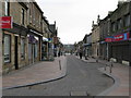
Carluke Town Centre
In common with many places now, this is predominantly a pedestrian precinct. Until the 1970's, this was the road to Carnwath and then on to Peebles.
The church in the distance is the United Reformed Church.
Image: © G Laird
Taken: 15 Mar 2009
0.04 miles
2
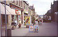
High Street Carluke
Vehicle access has changed recently - Image
Image: © Jim Smillie
Taken: Unknown
0.04 miles
3
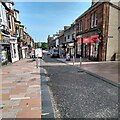
High Street Carluke 2021
Contrast with 1986 photo Image
Image: © Jim Smillie
Taken: 23 Jul 2021
0.05 miles
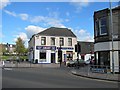
5
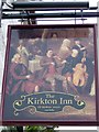
Sign for the Kirkton Inn
Sign for the inn found beside the A73, Kirkton Street.
Image: © Maigheach-gheal
Taken: 5 Apr 2010
0.07 miles
6
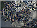
Carluke from the air
Looking along Market Road to Belstane Road.
Image: © Thomas Nugent
Taken: 9 Feb 2018
0.08 miles
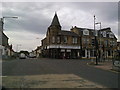
8
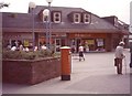
Rankin Gait Carluke
Presto supermarket dates this photo, however Greggs the baker is still there.
Image: © Jim Smillie
Taken: Unknown
0.09 miles
9

St.Luke's Graveyard, Belfry and ruins of Church
Carluke parish church, which belonged to Lesmahagow Priory, was dedicated to St Andrew, but there was an earlier dedication to St Luag or Maluag. Fragments remain of the 14th or 15th c church, which measured 90' x 24'. In ruins by 1650, it was repaired, and a belfry added in 1715. This church was replaced in 1799 by the present parish church, and was dismantled early in the 19th century.
Image: © Digitalbabe
Taken: 2 Jul 2011
0.10 miles