1
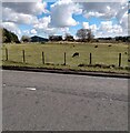
Netherton Farm
Rare breed sheep and lambs in field
Image: © Jim Smillie
Taken: 14 Apr 2021
0.02 miles
2
Netherton Farm
Viewed from the M8 motorway.
Image: © Thomas Nugent
Taken: 14 Jul 2013
0.03 miles
3
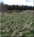
Netherton Farm
This was once a coalfield. Now much of the land is being planted with trees.
Image: © Richard Webb
Taken: 2 Jun 2006
0.03 miles
4
Netherton Farm
Viewed from a coach on the M8 motorway.
Image: © Thomas Nugent
Taken: 6 Sep 2017
0.07 miles
5
Woodland at Netherton Farm
An area of restored open-cast mining landscape, with a good growth of Cow Parsley [Anthriscus sylvestris].
Image: © M J Richardson
Taken: 18 Jun 2021
0.14 miles
6
Farmland by the M8 motorway
Near Netherton Farm, as seen from an east bound coach.
Image: © Thomas Nugent
Taken: 13 Aug 2019
0.15 miles
7
Southrigg Colliery Remains
Southrigg Colliery was a relatively recent short-lived open-cast coal mine. It was operational for just 12 years and closed in 1950, and employed around 100 men.
A 1950s surveyed OS map still shows a building at this spot, and is where I took its name from. Canmore - the arm of Historic Environment Scotland that assiduously details all traces of human activity in the landscape - however refers to it as 'Netherton Mine'; Netherton Farm is situated just South of here.
Presumably this would have once been the site of the main building - probably made up of offices, changing rooms, toilets and the miners' canteen, referenced in the Canmore write-up as a, "piece canteen run by workmen [please note that 'piece' is a colloquialism for sandwich]". It is surprising that back in the days of union power, stoves weren't demanded - though this could have had something to do with resources being stretched at the beginning of the Second World War I suppose.
I initially presumed that the odd criss-cross nature of the remains of this brick and concrete structure - along with the presence of regular small square holes at the top of the 'walls' with vertical metal bars inside - hinted at some unknown mining activities having taken place here previously. On reflection, though, this may well just be how foundations were quickly built on the boggy ground round these parts.
The irregular shaped remains cover an area of around 30 by 20 feet.
Image: © Ian Dodds
Taken: 21 Aug 2022
0.17 miles
8
Netherton Woodland
Signpost and footpath map at entrance to Netherton Woodland.
Image: © Jim Smillie
Taken: 24 Feb 2011
0.17 miles
9
Remains of pit buildings
Site of Southrigg Colliery Pits 7 & 8
Image: © Jim Smillie
Taken: 14 Apr 2021
0.18 miles
10
Variable Message Sign (VMS) on the M8 near to Harthill
A variable message sign on the eastbound carriageway of the M8 near to Harthill in North Lanarkshire.
Variable message signs (VMS), also sometimes referred to as matrix signs, are electronic traffic signs used on motorways (and some other major routes) to give drivers information about special events and to warn them about traffic congestion, accidents, incidents, roadworks or speed limits on specific sections of the route. They may also suggest (or instruct) drivers to take alternative routes, limit speed, warn of duration and location of the incidents or just inform of the traffic conditions. The large VMS ahead is giving drivers an estimation of how long it is likely to take for them to reach Junction 3 (Livingston) and the junction with the M9 (and hence gives an idea of how congested the motorway is ahead).
Image: © David Dixon
Taken: 3 Aug 2019
0.18 miles


