IMAGES TAKEN NEAR TO
Hirst Road, SHOTTS, ML7 5TH

Introduction

This page details the photographs taken nearby to Hirst Road, ML7 5TH by members of the Geograph project.

The Geograph project started in 2005 with the aim of publishing, organising and preserving representative images for every square kilometre of Great Britain, Ireland and the Isle of Man.

There are currently over 7.5m images from over14,400 individuals and you can help contribute to the project by visiting https://www.geograph.org.uk

Image Map


Images are licensed for reuse under creativecommons.org/licenses/by-sa/2.0
Notes
  • Clicking on the map will re-center to the selected point.
  • The higher the marker number, the further away the image location is from the centre of the postcode.

Image Listing (6 Images Found)

Images are licensed for reuse under creativecommons.org/licenses/by-sa/2.0
Image
Details
Distance
1
Harness racing track
Just south of the M8 near junction 5
Image: © Jim Smillie Taken: 16 Apr 2009
0.11 miles
2
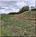
Earth banks and trees
Screening the works at Tam's Loup Quarry
Image: © Jim Smillie Taken: 11 May 2021
0.14 miles
3
Rough pasture on Shotts Road
With a small tip of mine waste, colonised by trees.
Image: © M J Richardson Taken: 31 May 2021
0.15 miles
4
Hirst Road
The B7066 (Hirst Road) was upgraded in the 1960's as the M8 east of Salsburgh follows the route of the A8. This shows the original Hirst Road passing through South Hirst farm.
Image: © Jim Smillie Taken: 16 Apr 2009
0.18 miles
5
Houses at Hirst
More modern and undoubtedly more comfortable houses than the old farm house in Image and Image
Image: © Anne Burgess Taken: 21 Mar 2009
0.23 miles
6
Tam's Loup Quarry entrance.
This entrance was made when the quarry expanded in the 1990's. Along the south side of the road is a landscaped embankment made to screen the quarry.
Image: © Jim Smillie Taken: 16 Apr 2009
0.24 miles