IMAGES TAKEN NEAR TO
Livingstone Quadrant, SHOTTS, ML7 5PY

Introduction

This page details the photographs taken nearby to Livingstone Quadrant, ML7 5PY by members of the Geograph project.

The Geograph project started in 2005 with the aim of publishing, organising and preserving representative images for every square kilometre of Great Britain, Ireland and the Isle of Man.

There are currently over 7.5m images from over14,400 individuals and you can help contribute to the project by visiting https://www.geograph.org.uk

Image Map


Images are licensed for reuse under creativecommons.org/licenses/by-sa/2.0
Notes
  • Clicking on the map will re-center to the selected point.
  • The higher the marker number, the further away the image location is from the centre of the postcode.

Image Listing (8 Images Found)

Images are licensed for reuse under creativecommons.org/licenses/by-sa/2.0
Image
Details
Distance
1
New houses in Eastfield
A recent housing development on the edge of an old mining village
Image: © James Allan Taken: 10 Apr 2006
0.07 miles
2
Band Hall
This red brick building is the only surviving part of Benhar primary. It is used as a practice hall for the Eastfield and Harthill Flute Orchestra, who give many charity concerts in the area. The newer houses are built on the site of the rest of Benhar Primary.
Image: © Jim Smillie Taken: 14 Oct 2009
0.12 miles
3
View to Eastfield
With Harthill in the distance.
Image: © Jim Smillie Taken: 20 Mar 2009
0.14 miles
4
Old Eastfield Street
With St Andrew's Church on the left.
Image: © Jim Smillie Taken: 14 Oct 2009
0.17 miles
5
Eastfield and Harthill
Local festival day held every July.
Image: © Robert Murray Taken: 9 Jul 2016
0.20 miles
6
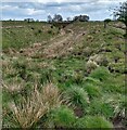
Disused mineral line
This was on the Shotts branch of the Monkland railway
Image: © Jim Smillie Taken: 11 May 2021
0.22 miles
7
Mini-Roundabout entering Eastfield
Looking along Edinburgh Road at the junction with Breslin Terrace.
Image: © G Laird Taken: 16 Dec 2012
0.22 miles
8
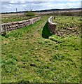
Bridge over disused railway
Near Paxtane Farm
Image: © Jim Smillie Taken: 11 May 2021
0.22 miles