
IMAGES TAKEN NEAR TO
Foulburn Road, SHOTTS, ML7 5FA
Introduction
This page details the photographs taken nearby to Foulburn Road, ML7 5FA by members of the Geograph project.
The Geograph project started in 2005 with the aim of publishing, organising and preserving representative images for every square kilometre of Great Britain, Ireland and the Isle of Man.

There are currently over 7.5m images from over14,400 individuals and you can help contribute to the project by visiting https://www.geograph.org.uk
Image Map
Images are licensed for reuse under creativecommons.org/licenses/by-sa/2.0
Notes
- Clicking on the map will re-center to the selected point.
- The higher the marker number, the further away the image location is from the centre of the postcode.
Image Listing (5 Images Found)
Images are licensed for reuse under creativecommons.org/licenses/by-sa/2.0
Image
Details
Distance
1
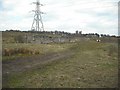
Ruin: Foulburn
Towers of Hartwood behind trees.
Image: © Jim Smillie
Taken: 13 Apr 2009
0.02 miles
2
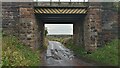
Foulburn Railway Bridge
I'm pretty sure that the bridge nameplate wrongly calls the bridge 'Fullburn', but the nameplate is too far away to tell, and my efforts to find an online exhaustive listing of railway bridge numbers and names have been unsuccessful.
I did, however, stumble across the Railway Data Centre website. I imagine trainspotters have known about it for ages, but if anyone hasn't come across it, it's quite the thing. It turns out that all railway bridges are numbered sequentially - obviously a fair proportion of the original bridges have been demolished since, leading to gaps between numbers - between railway junctions. In other words, each stand-alone section of track has its own bridge numbers. The easiest way to find out the ELR (Engineer's Line Reference) code for a certain section of track is to type in the nearest railway station. These codes almost always appear on the bridge's nameplates too.
Once armed with the ELR you can look at a table of bridges along that section of track. Distances from the datum junction are given along with the type of bridge (beam / underline), its construction material (early steel), and a grading of its condition (58%) recorded at the date of its last official inspection (2012) Mostly, but not in this case, the bridge name is given, and occasionally, as in this case, the date of construction is given (1869).
The gradient of the track between points along the section is also given, along with a chart - it is remarkable how flat the railways actually are. On top of this, station details are included, along with those of tunnels and level crossings, though EGS2 - the ELR code for this track section (Edinburgh to Glasgow via Shotts) - has neither.
Foulburn was a farm, situated to the left of the picture, on this side of the railway. A few traces remain but the site is now in the later stages of being turned into an official gypsy site - accordingly there are plenty of horses grazing in subdivided fields directly behind the new development.
Although an unnamed drain or burn ran South into the old farm area, there is no Foul Burn marked on any maps here past or present. Since Foul Burn - of which there are a few in Scotland - seems to have always referred to a foul smelling burn, it seems odd that people would name anything after it. But maybe back then house names were like personal names and you just had to go with the name you were given!
Image: © Ian Dodds
Taken: 12 Aug 2021
0.04 miles
3
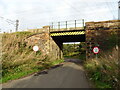
Railway bridge over Foulburn Road
Carries the line from Glasgow Central to Edinburgh Waverley via Shotts.
Image: © JThomas
Taken: 17 Sep 2021
0.05 miles
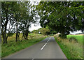
5
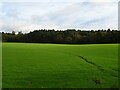
Grazing and woodland, Newmill
The twin towers of Hartwood Hospital just visible to the left. See Image]
Image: © JThomas
Taken: 17 Sep 2021
0.18 miles