
IMAGES TAKEN NEAR TO
Hirst Road, SHOTTS, ML7 4NU
Introduction
This page details the photographs taken nearby to Hirst Road, ML7 4NU by members of the Geograph project.
The Geograph project started in 2005 with the aim of publishing, organising and preserving representative images for every square kilometre of Great Britain, Ireland and the Isle of Man.

There are currently over 7.5m images from over14,400 individuals and you can help contribute to the project by visiting https://www.geograph.org.uk
Image Map
Images are licensed for reuse under creativecommons.org/licenses/by-sa/2.0
Notes
- Clicking on the map will re-center to the selected point.
- The higher the marker number, the further away the image location is from the centre of the postcode.
Image Listing (7 Images Found)
Images are licensed for reuse under creativecommons.org/licenses/by-sa/2.0
Image
Details
Distance
1
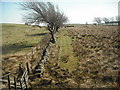
Well marked boundary
These fields are separated by fences, ditch, dyke and trees.
Image: © Jim Smillie
Taken: 16 Apr 2010
0.18 miles
2
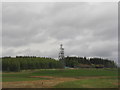
TV transmitters near Kirk of Shotts
As seen from the M8. The main and original Kirk o' Shotts transmitter, Britain's first-ever TV transmission mast, well known by name, if not physically, by most people of a certain mature age, is out of view just 230m to the left of these smaller masts.
Image: © M J Richardson
Taken: 29 Apr 2012
0.18 miles
3
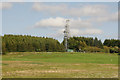
Transmitter at Kirk of Shotts
Not the main transmitter on this hill, which is to the left, but one of several smaller transmitters.
Image: © Mike Pennington
Taken: 2 Jun 2011
0.19 miles
4
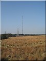
Television transmitter
Rough grazing and a mast near the summits of the old A8 (Hirst Road) and modern M8.
Image: © Richard Webb
Taken: 20 Mar 2009
0.20 miles
5

Masts seen from Hirst Road
The tall mast is the former Kirk o' Shotts BBC mast erected in 1952.
Image: © Jim Smillie
Taken: 24 Apr 2026
0.22 miles
6
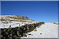
Outcrop and drystane dyke, Fortissat Road
Snow on an old track which was once a public road across the moorland to Easter Fortissat.
Image: © Alan O'Dowd
Taken: 2 Feb 2019
0.25 miles
7
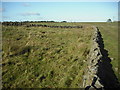
Converging dykes
Beside Fortisset Road.
Image: © Jim Smillie
Taken: 16 Oct 2009
0.25 miles