
IMAGES TAKEN NEAR TO
Salsburgh, SHOTTS, ML7 4NS
Introduction
This page details the photographs taken nearby to ML7 4NS by members of the Geograph project.
The Geograph project started in 2005 with the aim of publishing, organising and preserving representative images for every square kilometre of Great Britain, Ireland and the Isle of Man.

There are currently over 7.5m images from over14,400 individuals and you can help contribute to the project by visiting https://www.geograph.org.uk
Image Map
Images are licensed for reuse under creativecommons.org/licenses/by-sa/2.0
Notes
- Clicking on the map will re-center to the selected point.
- The higher the marker number, the further away the image location is from the centre of the postcode.
Image Listing (5 Images Found)
Images are licensed for reuse under creativecommons.org/licenses/by-sa/2.0
Image
Details
Distance
1
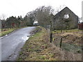
Roughdike
Long since abandoned farm and terraced farm cottages.
Image: © G Laird
Taken: 20 Feb 2011
0.01 miles
2
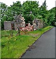
Ruin at Roughdike
Contrast with the well maintained gate
Image: © Jim Smillie
Taken: 20 Jun 2021
0.02 miles
3
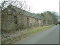
Roughdike
Looking rougher now than when it was named. One of several farms around Shotts in this upland district of relatively poor soils which have been abandoned
Image: © James Allan
Taken: 10 Apr 2006
0.02 miles
4
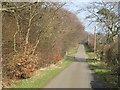
Muiredge and Jersay Road
A railway once crossed in the dip. It served a colliery to the north.
Image: © Richard Webb
Taken: 20 Mar 2009
0.14 miles
5
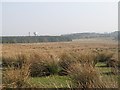
Rough grassland by Roughdike
Rashy ground amongst forestry plantations north of Shotts.
Image: © Richard Webb
Taken: 20 Mar 2009
0.18 miles