
IMAGES TAKEN NEAR TO
Drumbowie Crescent, SHOTTS, ML7 4NP
Introduction
This page details the photographs taken nearby to Drumbowie Crescent, ML7 4NP by members of the Geograph project.
The Geograph project started in 2005 with the aim of publishing, organising and preserving representative images for every square kilometre of Great Britain, Ireland and the Isle of Man.

There are currently over 7.5m images from over14,400 individuals and you can help contribute to the project by visiting https://www.geograph.org.uk
Image Map
Images are licensed for reuse under creativecommons.org/licenses/by-sa/2.0
Notes
- Clicking on the map will re-center to the selected point.
- The higher the marker number, the further away the image location is from the centre of the postcode.
Image Listing (20 Images Found)
Images are licensed for reuse under creativecommons.org/licenses/by-sa/2.0
Image
Details
Distance
1
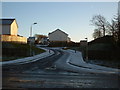
Kate's Well Drive
Modern estate built on land at former Craighead Farm.
Image: © Jim Smillie
Taken: 5 Jan 2009
0.02 miles
2
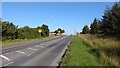
B7066 approaching Salsburgh
Former A8 Glasgow-Edinburgh road with its distinctive wide grass verge on one side.
This used to be kept mown throughout the summer.
Image: © Jim Smillie
Taken: 29 Sep 2015
0.09 miles
3
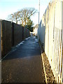
The ?Avenue?
This lane is on the line of the ‘Avenue’ which led to Craighead Farm, now long gone.
Image: © Jim Smillie
Taken: 5 Jan 2009
0.09 miles
4
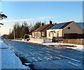
West end of Main Street
The first cottage probably dates from about 1890. Appears on 1895 valuation roll.
Image: © Jim Smillie
Taken: 8 Jan 2021
0.12 miles
6
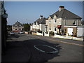
Grossart Street
Council houses built in the 1920's. Named after Dr. Grossart who wrote the 'History of the Parish of Shotts' published in 1880. Many of the tenants have taken up the option of 'right to buy'.
Image: © Jim Smillie
Taken: 16 Apr 2009
0.16 miles
7
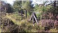
Concrete Fenceposts
Used to delineate boundaries along the course of A8 Glasgow-Edinburgh Road when it was constructed in 1930.
Image
Image
Image: © Jim Smillie
Taken: 29 Sep 2015
0.16 miles
8
New footbridge
Almost 5 years since the central section of the original footbridge was brought down,
a new footbridge is in place across the B7066 (formerly the A8) Image
Image: © Jim Smillie
Taken: 19 Jun 2014
0.17 miles
9
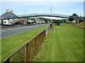
Footbridge
During the 1950s when the main Glasgow to Edinburgh trunk road (A8) passed through the village the need for a road bridge to improve the safety of pedestrians was raised at Westminster on several occasions. The bridge was completed in 1961 only 6 years before the M8 bypassed the village to the north in August 1967.
Image: © Jim Smillie
Taken: 21 Jul 2008
0.18 miles
10
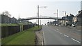
Footbridge, Salsburgh
A relic from the days when this road was the 3 lane A8 - the main road between Glasgow and Edinburgh. The bridge is still required as the road remains busy even though now replaced by a motorway.
Image: © Richard Webb
Taken: 20 Mar 2009
0.18 miles