
IMAGES TAKEN NEAR TO
Main Street, SHOTTS, ML7 4LT
Introduction
This page details the photographs taken nearby to Main Street, ML7 4LT by members of the Geograph project.
The Geograph project started in 2005 with the aim of publishing, organising and preserving representative images for every square kilometre of Great Britain, Ireland and the Isle of Man.

There are currently over 7.5m images from over14,400 individuals and you can help contribute to the project by visiting https://www.geograph.org.uk
Image Map
Images are licensed for reuse under creativecommons.org/licenses/by-sa/2.0
Notes
- Clicking on the map will re-center to the selected point.
- The higher the marker number, the further away the image location is from the centre of the postcode.
Image Listing (16 Images Found)
Images are licensed for reuse under creativecommons.org/licenses/by-sa/2.0
Image
Details
Distance
2
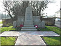
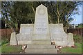
Salsburgh War Memorial
The memorial for the Great War is inside Kirk O' Shotts Church.
http://www.salsburghheritagegroup.co.uk/local_churches_26.html
Image: © Jim Smillie
Taken: 18 Mar 2009
0.03 miles
3
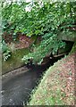
Shotts Burn
Flowing from under B7066 (former A8). The tunnel dates from the construction of Glasgow-Edinburgh Road (1930)
Image: © Jim Smillie
Taken: 16 Jul 2020
0.04 miles
4

Entering Salsburgh from the East
The road on the left is the B7066 (the former A8). The road on the right goes through the main part of Salsburgh.
The Salsburgh second world war memorial is at the corner.
Image: © G Laird
Taken: 18 Jun 2012
0.04 miles
5

Shotts Burn: Between the 'Glenbrae' and the 'new road'
This part of Main Street is known as the Glenbrae and older residents of the village refer to the former A8 as the 'new road' (1930)
Image: © Jim Smillie
Taken: 16 Jul 2020
0.04 miles
6
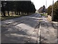
B7066 (Old A8)
This section of the Glasgow-Edinburgh Road was built to bypass Salsburgh starting in the summer of 1930. Only a few years later Lanarkshire County Council began building houses on the south side. What was originally a bypass then appeared to have been built through the middle of the village. Image
Image: © Jim Smillie
Taken: 16 Mar 2021
0.05 miles
7

Shotts Burn
About to pass under the B7066 (former A8(T) road)
Image: © Jim Smillie
Taken: 26 Mar 2026
0.06 miles
8
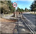
B7066 Hirst Road
This is where the B7066 diverges from the route of the A8 Glasgow-Edinburgh Road. The A8 followed the route of the path on the left and passed on the north side of Kirk o' Shotts school.
Image: © Jim Smillie
Taken: 16 Mar 2021
0.12 miles
9

Field: rougher than rough grazing
Houses on Kirkview Avenue beyond the trees.
Image: © Jim Smillie
Taken: 26 Mar 2026
0.14 miles
10
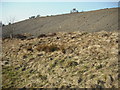
Spoil heap
Remains of ironstone workings.
Image: © Jim Smillie
Taken: 18 Mar 2009
0.16 miles