
IMAGES TAKEN NEAR TO
Springfield Road, SHOTTS, ML7 4LP
Introduction
This page details the photographs taken nearby to Springfield Road, ML7 4LP by members of the Geograph project.
The Geograph project started in 2005 with the aim of publishing, organising and preserving representative images for every square kilometre of Great Britain, Ireland and the Isle of Man.

There are currently over 7.5m images from over14,400 individuals and you can help contribute to the project by visiting https://www.geograph.org.uk
Image Map
Images are licensed for reuse under creativecommons.org/licenses/by-sa/2.0
Notes
- Clicking on the map will re-center to the selected point.
- The higher the marker number, the further away the image location is from the centre of the postcode.
Image Listing (18 Images Found)
Images are licensed for reuse under creativecommons.org/licenses/by-sa/2.0
Image
Details
Distance
1

B7066: road markings
Road markings for the original 3 lane A8 (T) Glasgow-Edinburgh road can be seen either side of the centre white line.
Image: © Jim Smillie
Taken: 8 Jul 2020
0.07 miles
2

Steps to Sheddenhall
Only handrails visible now. These steps became necessary when a cutting was made in 1930 across the track to Sheddenhall during the construction of the Glasgow-Edinburgh road A8(T)
Image: © Jim Smillie
Taken: 8 Jul 2020
0.09 miles
3
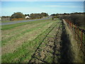
Grass verge by the B7066
The width of the road (formerly the A8) and the grass verge have not changed in my memory i.e. since the 1950's.
The original plan may have been for a future dual carriageway but this never happened.
The verge was used as a storage area during World War II with the dual purpose of preventing enemy aircraft landing.
Image: © Jim Smillie
Taken: 16 Oct 2009
0.10 miles
4
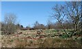
Sheddenhall: no more
A couple of piles of stone are all that's left of Sheddenhall cottage
Image: © Jim Smillie
Taken: 3 Apr 2021
0.11 miles
5
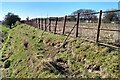
Glasgow-Edinburgh Highway boundary
Metal fence probably dating from time former A8 was constructed
Image: © Jim Smillie
Taken: 3 Apr 2021
0.12 miles
6
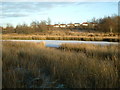
Frozen Pond
This pond was used in time gone by for curling and skating -providing the ice was thick enough for these purposes.
Image: © Jim Smillie
Taken: 5 Jan 2009
0.13 miles
7
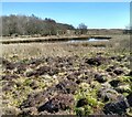
Pond: Sheddenhall
Formerly used for curling, now much smaller Image
Image: © Jim Smillie
Taken: 3 Apr 2021
0.15 miles
8
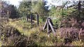
Concrete Fenceposts
Used to delineate boundaries along the course of A8 Glasgow-Edinburgh Road when it was constructed in 1930.
Image
Image
Image: © Jim Smillie
Taken: 29 Sep 2015
0.15 miles
9
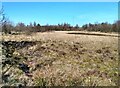
Former curling pond
Former curling pond boundary visible on left. Small area of open water on right
Image: © Jim Smillie
Taken: 3 Apr 2021
0.15 miles
10
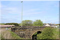
Bridge over dismantled Railway, Springfield Road, Salsburgh
Image: © Leslie Barrie
Taken: 23 May 2015
0.16 miles