IMAGES TAKEN NEAR TO
Bute Crescent, SHOTTS, ML7 4HF

Introduction

This page details the photographs taken nearby to Bute Crescent, ML7 4HF by members of the Geograph project.

The Geograph project started in 2005 with the aim of publishing, organising and preserving representative images for every square kilometre of Great Britain, Ireland and the Isle of Man.

There are currently over 7.5m images from over14,400 individuals and you can help contribute to the project by visiting https://www.geograph.org.uk

Image Map


Images are licensed for reuse under creativecommons.org/licenses/by-sa/2.0
Notes
  • Clicking on the map will re-center to the selected point.
  • The higher the marker number, the further away the image location is from the centre of the postcode.

Image Listing (9 Images Found)

Images are licensed for reuse under creativecommons.org/licenses/by-sa/2.0
Image
Details
Distance
1
Hannah Park, Shotts
Home of Shotts Bon Accord, Junior Football Club
Image: © Robert Guthrie Taken: 28 Apr 2007
0.12 miles
2
Houses at Burnside Crescent, Shotts
Looking across a wet football field by Calderhead Road.
Image: © M J Richardson Taken: 17 May 2012
0.16 miles
3
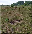
Raised bog, Shotts
An remnant of the pre industrial landscape. The peat bog would have been surrounded by collieries and railways once.
Image: © Richard Webb Taken: 24 Apr 2009
0.18 miles
4
Heather moorland
On raised peat bog north of Shotts
Image: © Jim Smillie Taken: 12 Jul 2021
0.18 miles
5
Entering Shotts along Calderhead Road
This is an area of light industry in Shotts.
Image: © G Laird Taken: 29 Nov 2012
0.20 miles
6
A little piece of gold at Centrelink 5
Kingcups, Marsh Marigolds or May Blobs (Caltha palustris) growing by the edge of a drain at this industrial site.
Image: © M J Richardson Taken: 17 May 2012
0.21 miles
7
Calderhead Road, Shotts
Looking northeast from a landscape pyramid at Centrelink 5 towards a disused tip, a reminder of the mining industry of the area.
Image: © M J Richardson Taken: 17 May 2012
0.22 miles
8
Calderhead Road
Running through an industrial estate on former colliery land.
Image: © Richard Webb Taken: 24 Apr 2009
0.24 miles
9
Shotts Scrubland
The coalmines may have been abandoned, but on both sides of this road just scrubland and a few trees break the view. Much of Scotland's countryside has been laid waste in the quest for coal (whether mined or opencast) and this particular road would not be high on anyone's tourist route, unless pit bings (which still remain) become popular.
Image: © Raymond Okonski Taken: 5 May 2007
0.25 miles