
IMAGES TAKEN NEAR TO
Methlick Avenue, AIRDRIE, ML6 9XT
Introduction
This page details the photographs taken nearby to Methlick Avenue, ML6 9XT by members of the Geograph project.
The Geograph project started in 2005 with the aim of publishing, organising and preserving representative images for every square kilometre of Great Britain, Ireland and the Isle of Man.

There are currently over 7.5m images from over14,400 individuals and you can help contribute to the project by visiting https://www.geograph.org.uk
Image Map
Images are licensed for reuse under creativecommons.org/licenses/by-sa/2.0
Notes
- Clicking on the map will re-center to the selected point.
- The higher the marker number, the further away the image location is from the centre of the postcode.
Image Listing (13 Images Found)
Images are licensed for reuse under creativecommons.org/licenses/by-sa/2.0
Image
Details
Distance
3
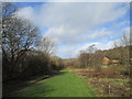
North Calder Heritage Trail
Follows the course of the Monkland Canal https://en.wikipedia.org/wiki/Monkland_Canal
Image: © Jonathan Thacker
Taken: 20 Feb 2020
0.14 miles
4

Canal Overflow Ford at Palacecraig
This spillway ford is found on the Monkland Canal
Image: © John Walton
Taken: 25 Jul 2026
0.16 miles

6
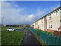
Footpath and housing, Cumbrae Place
Image: © Jonathan Thacker
Taken: 20 Feb 2020
0.17 miles
7

Woodland, Cromarty Road
A keek through the roadside woods along Sykeside Road to residential streets to the north.
Image: © Richard Webb
Taken: 22 Jan 2010
0.18 miles
8
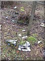
Dumped skates
Moss covered so they have been there some time - unusual litter off Sykeside Road.
Image: © Richard Webb
Taken: 22 Jan 2010
0.20 miles
9
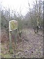
Woodland, Sikeside Road
A small scruffy wood beside the Sikeside Road and the road to Faskine.
Image: © Richard Webb
Taken: 22 Jan 2010
0.20 miles
10
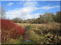
Footpath near Cairnhill
Cairnhill is off to the left. This is former industrial land.
Image: © Jonathan Thacker
Taken: 20 Feb 2020
0.22 miles