IMAGES TAKEN NEAR TO
Loch View, AIRDRIE, ML6 9TB

Introduction

This page details the photographs taken nearby to Loch View, ML6 9TB by members of the Geograph project.

The Geograph project started in 2005 with the aim of publishing, organising and preserving representative images for every square kilometre of Great Britain, Ireland and the Isle of Man.

There are currently over 7.5m images from over14,400 individuals and you can help contribute to the project by visiting https://www.geograph.org.uk

Image Map


Images are licensed for reuse under creativecommons.org/licenses/by-sa/2.0
Notes
  • Clicking on the map will re-center to the selected point.
  • The higher the marker number, the further away the image location is from the centre of the postcode.

Image Listing (10 Images Found)

Images are licensed for reuse under creativecommons.org/licenses/by-sa/2.0
Image
Details
Distance
1
The Post, Main Street, Calderbank
Image: © Leslie Barrie Taken: 23 May 2015
0.08 miles
2
The Diner, Calderbank
Image: © Chris Upson Taken: 9 Apr 2006
0.10 miles
3
Park in Calderbank
From Crown Street.
Image: © Stephen Sweeney Taken: 14 May 2014
0.10 miles
4
Crowwood Crescent, Calderbank
Outside Corpus Christi Primary School.
Image: © Stephen Sweeney Taken: 14 May 2014
0.13 miles
5
Calderbank Parish Church
Image: © Chris Upson Taken: 9 Apr 2006
0.14 miles
6
Calderbank Parish Church
Category C-listed. Built 1856, extended 1870 and remodelled 1908.
Image: © Leslie Barrie Taken: 23 May 2015
0.17 miles
7
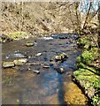
North Calder
Flowing between Chapelhall and Calderbank
Image: © Jim Smillie Taken: 12 Apr 2021
0.23 miles
8
Track between Calderbank and the Monkland Canal
A shower of hail and rain is moving in from the south-west.
Image: © Alan O'Dowd Taken: 13 Mar 2021
0.24 miles
9
Calderbank
Calderbank Road leading to... Calderbank.
Image: © Richard Webb Taken: 22 Jan 2010
0.24 miles
10
An Interesting Town-Sign
The boat pictured on the sign, 'The Vulcan', was built just over 200 years ago. The iron plates its hull was made out of were cut and bashed into shape at the Calderbank Forge, which once straddled North Calder Water, just a couple of hundred yards NorthEast of here. The forge expanded into an ironworks, and then a steelworks over time, eventually closing in the 1930s due to a decline in shipbuilding brought about by The Great Depression. It is thought to be the first iron-hulled vessel ever built and was operational for over 50 years, initially as a passenger ferry and then as a cargo boat. It was horse-drawn and went up and down the Forth And Clyde Canal. A big deal is made about its rivets being flush with the surface of the hull - I have no idea if this was just aesthetic, or provided other benefits. It didn't leak nearly as much as other boats of the time anyway, reports state.
Image: © Ian Dodds Taken: 21 May 2022
0.25 miles