IMAGES TAKEN NEAR TO
Gibb Street, AIRDRIE, ML6 8UG
Introduction
This page details the photographs taken nearby to Gibb Street, ML6 8UG by members of the Geograph project.
The Geograph project started in 2005 with the aim of publishing, organising and preserving representative images for every square kilometre of Great Britain, Ireland and the Isle of Man.

There are currently over 7.5m images from over14,400 individuals and you can help contribute to the project by visiting https://www.geograph.org.uk
Image Map
Images are licensed for reuse under creativecommons.org/licenses/by-sa/2.0
Notes
- Clicking on the map will re-center to the selected point.
- The higher the marker number, the further away the image location is from the centre of the postcode.
Image Listing (17 Images Found)
Images are licensed for reuse under creativecommons.org/licenses/by-sa/2.0
Image
Details
Distance
3
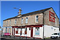
The Railway Inn, Lauchope Street, Chapelhall
Image: © Leslie Barrie
Taken: 23 May 2015
0.16 miles
5
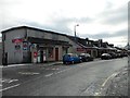
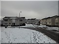
Shops in Chapelhall
On Lauchope Street.
Image: © Stephen Sweeney
Taken: 3 Dec 2012
0.18 miles
6
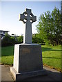
War Memorial in Chapelhall, Airdrie
The inscription reads "In memory of those men from Chapelhall killed in action 1939 - 1945"
Image: © Stevie Spiers
Taken: 24 May 2009
0.19 miles
7
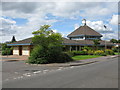
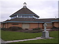
Chapelhall Library
At the corner of Woodhall Street (B799) and Methuen Road.
Image: © G Laird
Taken: 5 Aug 2011
0.19 miles
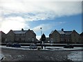
9
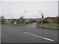
Junction of A73 and Bowhousebrae Road at Chapelhall in North Lanarkshire
Image: © James Denham
Taken: 11 Feb 2012
0.21 miles
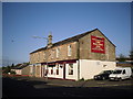
10
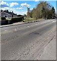
Former level crossing
Known locally as the White Gates a railway branch crossed the road to a brick works
Image: © Jim Smillie
Taken: 12 Apr 2021
0.21 miles