IMAGES TAKEN NEAR TO
Calderbank, AIRDRIE, ML6 8RT

Introduction

This page details the photographs taken nearby to ML6 8RT by members of the Geograph project.

The Geograph project started in 2005 with the aim of publishing, organising and preserving representative images for every square kilometre of Great Britain, Ireland and the Isle of Man.

There are currently over 7.5m images from over14,400 individuals and you can help contribute to the project by visiting https://www.geograph.org.uk

Image Map


Images are licensed for reuse under creativecommons.org/licenses/by-sa/2.0
Notes
  • Clicking on the map will re-center to the selected point.
  • The higher the marker number, the further away the image location is from the centre of the postcode.

Image Listing (13 Images Found)

Images are licensed for reuse under creativecommons.org/licenses/by-sa/2.0
Image
Details
Distance
1
North Calder Water
Flowing through the tunnel under the B802 at Calderbank. There is another tunnel to the right just out of the picture which is used by walkers but may originally have carried a mineral railway from the old Calderbank Ironworks to the canal.
Image: © Robert Murray Taken: 24 Aug 2009
0.06 miles
2
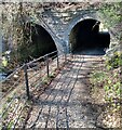
Tunnels under B802
North Calder and footpath side by side
Image: © Jim Smillie Taken: 12 Apr 2021
0.09 miles
3
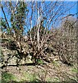
Rocks and roots
These trees taking foothold among the rocks
Image: © Jim Smillie Taken: 12 Apr 2021
0.11 miles
4
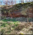
Steel works waste
The Calderbank Steel Works was just north of this
Image: © Jim Smillie Taken: 12 Apr 2021
0.12 miles
5
An Interesting Town-Sign
The boat pictured on the sign, 'The Vulcan', was built just over 200 years ago. The iron plates its hull was made out of were cut and bashed into shape at the Calderbank Forge, which once straddled North Calder Water, just a couple of hundred yards NorthEast of here. The forge expanded into an ironworks, and then a steelworks over time, eventually closing in the 1930s due to a decline in shipbuilding brought about by The Great Depression. It is thought to be the first iron-hulled vessel ever built and was operational for over 50 years, initially as a passenger ferry and then as a cargo boat. It was horse-drawn and went up and down the Forth And Clyde Canal. A big deal is made about its rivets being flush with the surface of the hull - I have no idea if this was just aesthetic, or provided other benefits. It didn't leak nearly as much as other boats of the time anyway, reports state.
Image: © Ian Dodds Taken: 21 May 2022
0.12 miles
6
Woodhall Cottage Road
An old straight road, now no longer part of the network, and shown as a "white road" on 1940s maps too. Today it leads to boarding kennels.
Image: © Richard Webb Taken: 22 Jan 2010
0.14 miles
7
Woodhall Cottage Road
An old road alignment - now gated.
Image: © Richard Webb Taken: 22 Jan 2010
0.15 miles
8
North Calder dam
The dam on the river which raised it sufficiently to enable a sluice to feed water into the Monkland Canal. The river was in spate at the time the pic was taken.
Image: © Robert Murray Taken: 24 Aug 2009
0.20 miles
9
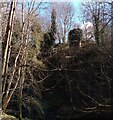
Ivy covered bridge supports
Evidence of one of the many mineral lines which were in this area
Image: © Jim Smillie Taken: 12 Apr 2021
0.20 miles
10
Industrial Legacy
This is not a natural rock formation but slag left over from the days of Calderbank Ironworks.
Image: © Robert Murray Taken: 24 Aug 2009
0.20 miles