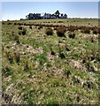
IMAGES TAKEN NEAR TO
Plains, AIRDRIE, ML6 8NS

Introduction

This page details the photographs taken nearby to ML6 8NS by members of the Geograph project.

The Geograph project started in 2005 with the aim of publishing, organising and preserving representative images for every square kilometre of Great Britain, Ireland and the Isle of Man.

There are currently over 7.5m images from over14,400 individuals and you can help contribute to the project by visiting https://www.geograph.org.uk

Image Map


Images are licensed for reuse under creativecommons.org/licenses/by-sa/2.0
Notes
  • Clicking on the map will re-center to the selected point.
  • The higher the marker number, the further away the image location is from the centre of the postcode.

Image Listing (11 Images Found)

Images are licensed for reuse under creativecommons.org/licenses/by-sa/2.0
Image
Details
Distance
1
View to Annieshill
Lots of redevelopment has occurred
Image: © Jim Smillie Taken: 24 Apr 2021
0.03 miles
2
Pasture, Anniesland
Improved grazing on lower ground. The rougher grassland on the hills has now been wooded.
Image: © Richard Webb Taken: 8 May 2009
0.09 miles
3
Car park, Annieshill
Car park for walks in the new Central Scotland Forest project, with the usual evidence of a burnt out car.
Image: © Richard Webb Taken: 8 May 2009
0.09 miles
4
Stepends Road and abandoned railway
Stepends Road runs south from the A89 Bathgate to Airdrie road near Plains, climbing out of the valley of North Calder Water along the slopes of Annies Hill and past the eponymous farm on the right. Immediately alongside the road, a strip of land now carrying an electricity line was originally a standard gauge railway siding that served ironstone and coal pits. The lower section of the line used a series of zigzag reversals to gain some height, but even so this section alongside the road would have taxed the motive power.
Image: © A-M-Jervis Taken: 14 Jan 2006
0.10 miles
5
View to Annieshill
View over pasture to Annieshill where some building conversion is taking place.
Image: © Jim Smillie Taken: 18 Apr 2009
0.11 miles
6
Annieshill Forest Walk
Image: © Texas Radio and The Big Beat Taken: 5 May 2010
0.12 miles
7
Annies Hill
Dolerite boulders on the slopes of Annies Hill. A lot of the land around here is now wooded.
Image: © Richard Webb Taken: 8 May 2009
0.13 miles
8
Stepends road
Puddles at the bend in the road, evidence of the coming and going heavy showers. Looking towards Annieshill farm.
Image: © Alan Stewart Taken: 9 Jul 2006
0.15 miles
9
Brown's Burn below Stepends Road
In spate after a summer of constant rain.
Image: © Robert Murray Taken: 24 Jul 2009
0.16 miles
10
Brown's Burn
Near Annie's Hill as it heads toward the North Calder south of [the] Plains.
Image: © Robert Murray Taken: 24 Jul 2009
0.22 miles