
IMAGES TAKEN NEAR TO
Lammermuir Way, AIRDRIE, ML6 8BE
Introduction
This page details the photographs taken nearby to Lammermuir Way, ML6 8BE by members of the Geograph project.
The Geograph project started in 2005 with the aim of publishing, organising and preserving representative images for every square kilometre of Great Britain, Ireland and the Isle of Man.

There are currently over 7.5m images from over14,400 individuals and you can help contribute to the project by visiting https://www.geograph.org.uk
Image Map
Images are licensed for reuse under creativecommons.org/licenses/by-sa/2.0
Notes
- Clicking on the map will re-center to the selected point.
- The higher the marker number, the further away the image location is from the centre of the postcode.
Image Listing (7 Images Found)
Images are licensed for reuse under creativecommons.org/licenses/by-sa/2.0
Image
Details
Distance
1
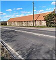
Byre at Bailside Farm
With air vents on wall and corrugated metal roof
Image: © Jim Smillie
Taken: 12 Apr 2021
0.15 miles
2
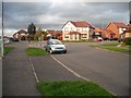
Rockcliffe Path
New housing, Chapelhall.
Image: © Richard Webb
Taken: 4 Oct 2009
0.15 miles
3
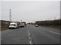
The A73 (Bellsfield Road) at Chapelhall
Image: © James Denham
Taken: 11 Feb 2012
0.17 miles
4
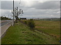
Bailside Farm
This farm has been known as Bellside but seems to have returned to an older name.
Image: © Jim Smillie
Taken: 7 May 2009
0.18 miles
5
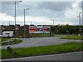
Bill posters
Advertising this week's star buy.
Image: © Jim Smillie
Taken: 7 May 2009
0.20 miles
6
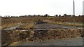
Land awaiting development, Chapelhall
The dead end exit from a roundabout is shown on the 1:50,000 map. Until the road is completed an earthbank is charged with keeping the dumpers away.
Image: © Richard Webb
Taken: 22 Jan 2010
0.20 miles
7
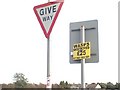
Signs, Rockcliffe Path
A bit late now in October.
Image: © Richard Webb
Taken: 4 Oct 2009
0.21 miles