IMAGES TAKEN NEAR TO
Stirling Road Industrial Estate, AIRDRIE, ML6 7UD

Introduction

This page details the photographs taken nearby to Stirling Road Industrial Estate, ML6 7UD by members of the Geograph project.

The Geograph project started in 2005 with the aim of publishing, organising and preserving representative images for every square kilometre of Great Britain, Ireland and the Isle of Man.

There are currently over 7.5m images from over14,400 individuals and you can help contribute to the project by visiting https://www.geograph.org.uk

Image Map


Images are licensed for reuse under creativecommons.org/licenses/by-sa/2.0
Notes
  • Clicking on the map will re-center to the selected point.
  • The higher the marker number, the further away the image location is from the centre of the postcode.

Image Listing (17 Images Found)

Images are licensed for reuse under creativecommons.org/licenses/by-sa/2.0
Image
Details
Distance
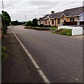
1
Airdrie, Dalmacoulter Road
Image: © Robert Murray Taken: 28 Jul 2011
0.09 miles
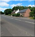
2
Airdrie, Dykehead Road
On a dreich day.
Image: © Robert Murray Taken: 28 Jul 2011
0.10 miles
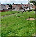
3
Cottages on Dykehead Road
Old maps suggest these date from early 20th century
Image: © Jim Smillie Taken: 14 Jul 2021
0.14 miles
4
Cottages on Stirling Road
In the 19th century this was Baird Street
Image: © Jim Smillie Taken: 14 Jul 2021
0.14 miles
5
Junction of the A73 Stirling Road and Dykehead Road
Image: © Elliott Simpson Taken: 7 Feb 2013
0.16 miles
6
Crossroads on the A73 in the northern outskirts of Airdrie
The point where a minor road crosses the A73.
Image: © G Laird Taken: 20 Jun 2012
0.16 miles
7
Stirling Road, Airdrie
The A73 as it passes Holehills.
Image: © Stephen Sweeney Taken: 19 Mar 2014
0.16 miles
8
Playing fields, Dykehead Road
Flats beyond playing fields. Stirling Road (A73) in the foreground.
Image: © Richard Webb Taken: 17 Aug 2010
0.17 miles
9
Housing estate: Holehills
Corner of Holehills Drive and Holehills Place
Image: © Jim Smillie Taken: 14 Jul 2021
0.19 miles
10
New houses, Stirling Road
In the northwest quadrant of the Stirling Road/Dykehead Road crossroads.
Image: © Richard Webb Taken: 17 Aug 2010
0.21 miles