IMAGES TAKEN NEAR TO
Drumgray Gardens, AIRDRIE, ML6 7TZ

Introduction

This page details the photographs taken nearby to Drumgray Gardens, ML6 7TZ by members of the Geograph project.

The Geograph project started in 2005 with the aim of publishing, organising and preserving representative images for every square kilometre of Great Britain, Ireland and the Isle of Man.

There are currently over 7.5m images from over14,400 individuals and you can help contribute to the project by visiting https://www.geograph.org.uk

Image Map


Images are licensed for reuse under creativecommons.org/licenses/by-sa/2.0
Notes
  • Clicking on the map will re-center to the selected point.
  • The higher the marker number, the further away the image location is from the centre of the postcode.

Image Listing (16 Images Found)

Images are licensed for reuse under creativecommons.org/licenses/by-sa/2.0
Image
Details
Distance
1
Wattston from Standrigg Memorial Park
Image: © Richard Webb Taken: 16 Sep 2009
0.07 miles
2
Greengairs Convenience Store and Post Office
On Greengairs Road.
Image: © JThomas Taken: 29 Jun 2017
0.08 miles
3
Bus depot, Wattston
Image: © John Lord Taken: 26 Sep 2008
0.09 miles
4
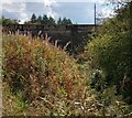
Is it a bridge?
Where Cameron Burn passes under Greengairs Road, hidden by vegetation
Image: © Jim Smillie Taken: 29 Sep 2022
0.10 miles
5
Greengairs Bowling Club
Image: © Iain Thompson Taken: 1 Apr 2006
0.10 miles
6
Home for Old Buses, Greengairs
Image: © Iain Thompson Taken: 1 Apr 2006
0.12 miles
7
Housing at Wattson in North Lanarkshire
Image: © James Denham Taken: 11 Feb 2012
0.14 miles
8
Wattston and Standrigg Memorial Park
Wattson seen from a disused railway within the park.
Image: © Richard Webb Taken: 16 Sep 2009
0.14 miles
9
Greengairs Road
The main road through the village of Wattston, looking east.
Image: © Anne Burgess Taken: 24 Aug 2013
0.15 miles
10
Tidy hedge and overgrown field
Nothing has grazed here for a long time
Image: © Jim Smillie Taken: 29 Sep 2022
0.19 miles