
IMAGES TAKEN NEAR TO
Glen Terrace, AIRDRIE, ML6 7PY
Introduction
This page details the photographs taken nearby to Glen Terrace, ML6 7PY by members of the Geograph project.
The Geograph project started in 2005 with the aim of publishing, organising and preserving representative images for every square kilometre of Great Britain, Ireland and the Isle of Man.

There are currently over 7.5m images from over14,400 individuals and you can help contribute to the project by visiting https://www.geograph.org.uk
Image Map
Images are licensed for reuse under creativecommons.org/licenses/by-sa/2.0
Notes
- Clicking on the map will re-center to the selected point.
- The higher the marker number, the further away the image location is from the centre of the postcode.
Image Listing (33 Images Found)
Images are licensed for reuse under creativecommons.org/licenses/by-sa/2.0
Image
Details
Distance
1
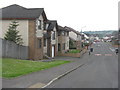
Housing estate at Caldercruix
Looking west from the end of Station Road to Easterton Drive.
Image: © M J Richardson
Taken: 19 May 2014
0.06 miles
2
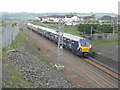
Mixed train approaching Caldercruix
Part-ScotRail and part-SPT [Strathclyde Partnership for Transport].
Image: © M J Richardson
Taken: 19 May 2014
0.07 miles
3
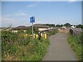
Bridge over a disused railway, Caldercruix
Now a bridge over a railway under construction. The cycle path was closed soon after this was taken, and the railway between Bathgate and Airdrie is being reopened.
The sign says: Blackridge 5, Edinburgh 37 and Plains 1 1/2 Glasgow 22.
Image: © Richard Webb
Taken: 25 Jul 2008
0.10 miles
4
Corner of former St Mary's Primary site
Near the top of Glen Road
Image: © Jim Smillie
Taken: 26 Apr 2021
0.10 miles
5
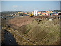
Caldercruix: new housing
New housing beside the North Calder, near to the site of the former paper mills
Image: © Jim Smillie
Taken: 18 Mar 2009
0.12 miles
6
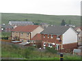
Craigsmill Wynd
New housing by the railway, and overlooking the valley of the North Calder Water. The smaller, older, building in the distance is The Craig Institute Image
Image: © M J Richardson
Taken: 19 May 2014
0.12 miles
7
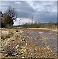
Site of St Mary's Primary
Now on a joint campus with Glengowan Primary on the other side of the village
Image: © Jim Smillie
Taken: 26 Apr 2021
0.13 miles
8
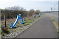
New blue legs
The blue leg sculptures in their new position beside ncn 75.
Image: © PeterJG1970
Taken: 21 Apr 2014
0.13 miles
9
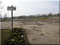
Glengowan Primary School (Former Site)
Image: © Raymond Okonski
Taken: 15 Apr 2007
0.13 miles
10
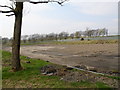
Glengowan Primary School (Former Site)
Although still shown on the OS map, the local council jumped on the bandwagon to have someone else build the school nearby and they'd rent it for 30 years instead. The original school stood on this site, but has now been demolished and the rest left as shown.
Image: © Raymond Okonski
Taken: 15 Apr 2007
0.13 miles