IMAGES TAKEN NEAR TO
Liberty Road, AIRDRIE, ML6 7PL

Introduction

This page details the photographs taken nearby to Liberty Road, ML6 7PL by members of the Geograph project.

The Geograph project started in 2005 with the aim of publishing, organising and preserving representative images for every square kilometre of Great Britain, Ireland and the Isle of Man.

There are currently over 7.5m images from over14,400 individuals and you can help contribute to the project by visiting https://www.geograph.org.uk

Image Map


Images are licensed for reuse under creativecommons.org/licenses/by-sa/2.0
Notes
  • Clicking on the map will re-center to the selected point.
  • The higher the marker number, the further away the image location is from the centre of the postcode.

Image Listing (7 Images Found)

Images are licensed for reuse under creativecommons.org/licenses/by-sa/2.0
Image
Details
Distance
1
Roadside Burn, Caldercruix
Image: © Iain Thompson Taken: 1 Apr 2006
0.21 miles
2
Caldercruix
Convenience store in Caldercruix.
Image: © Richard Webb Taken: 24 Apr 2014
0.22 miles
3
Caldercruix
Despite the sign, this is not the edge of the village. Taken while having lunch/fielding insults from some of the locals (the bike probably set them off).
Image: © Richard Webb Taken: 13 Jun 2008
0.23 miles
4
Terrace on Gowan Brae
This terrace pre-dates most of the other houses on Gowan Brae
Image: © Jim Smillie Taken: 26 Apr 2021
0.23 miles
5
Post Millennium Mile Post
Milepost on Route 75 in Caldercruix.
Image: © Richard Webb Taken: 24 Apr 2014
0.24 miles
6
B825, Caldercruix
Approaching Caldercruix from the north, past Eastfield Wood.
Image: © Richard Webb Taken: 13 Jun 2008
0.24 miles
7
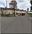
Caldercruix view
Houses and a Health Centre on Main Street.
Image: © Mary and Angus Hogg Taken: 26 Dec 2023
0.24 miles