IMAGES TAKEN NEAR TO
Lincoln Path, AIRDRIE, ML6 7LF

Introduction

This page details the photographs taken nearby to Lincoln Path, ML6 7LF by members of the Geograph project.

The Geograph project started in 2005 with the aim of publishing, organising and preserving representative images for every square kilometre of Great Britain, Ireland and the Isle of Man.

There are currently over 7.5m images from over14,400 individuals and you can help contribute to the project by visiting https://www.geograph.org.uk

Image Map


Images are licensed for reuse under creativecommons.org/licenses/by-sa/2.0
Notes
  • Clicking on the map will re-center to the selected point.
  • The higher the marker number, the further away the image location is from the centre of the postcode.

Image Listing (12 Images Found)

Images are licensed for reuse under creativecommons.org/licenses/by-sa/2.0
Image
Details
Distance
1
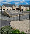
Housing development on former Boots Factory site
Panel from front of building as a memorial Image
Image: © Jim Smillie Taken: 14 Jul 2021
0.12 miles
2
Boots factory: Airdrie
A major employer in the town for more than 50 years, the closure of the factory was announced in 2003.
Image: © Jim Smillie Taken: 29 Mar 2009
0.13 miles
3
Factory behind the bushes
An industrial plant in Rawyards, well screened from the road by greenery.
Image: © James Allan Taken: 13 Jul 2006
0.14 miles
4
Airdrie, core path
Leads uphill to an old reservoir and open land which might be developed as a path network.
Image: © Robert Murray Taken: 4 Jul 2011
0.16 miles
5
Boots Factory Gatehouse (derelict)
Image: © Texas Radio and The Big Beat Taken: 6 Oct 2010
0.17 miles
6
Derelict House, Motherwell Street
Perhaps one day someone will buy this nice old house and return it to its former glory?
Image: © Texas Radio and The Big Beat Taken: 4 Feb 2010
0.18 miles
7
Airdrie, Rawyards
At the junction of Airdriehill Road and the B8058 which leads to Clarkston and the A89.
Image: © Robert Murray Taken: 4 Jul 2011
0.18 miles
8
A73 running north through Rawyards at Airdrie
In North Lanarkshire.
Image: © James Denham Taken: 11 Feb 2012
0.19 miles
9
Rawyards park
The red blaes pitch is being updated to an all weather surface. Also shown are St Margarets High School and Milton Court flats.
Image: © Jim Smillie Taken: 29 Mar 2009
0.20 miles
10
Football pitch: Rawyards
This was previously a red ash pitch which I mistakenly assumed would become an all weather pitch Image
Image: © Jim Smillie Taken: 14 Jul 2021
0.21 miles