
IMAGES TAKEN NEAR TO
McAllister Avenue, AIRDRIE, ML6 7DF
Introduction
This page details the photographs taken nearby to McAllister Avenue, ML6 7DF by members of the Geograph project.
The Geograph project started in 2005 with the aim of publishing, organising and preserving representative images for every square kilometre of Great Britain, Ireland and the Isle of Man.

There are currently over 7.5m images from over14,400 individuals and you can help contribute to the project by visiting https://www.geograph.org.uk
Image Map
Images are licensed for reuse under creativecommons.org/licenses/by-sa/2.0
Notes
- Clicking on the map will re-center to the selected point.
- The higher the marker number, the further away the image location is from the centre of the postcode.
Image Listing (16 Images Found)
Images are licensed for reuse under creativecommons.org/licenses/by-sa/2.0
Image
Details
Distance
1
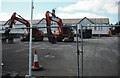
Ready for action
Heavy plant in place for the demolition of Clarkston Primary which has been replaced by a new school.
Image: © Jim Smillie
Taken: 18 Apr 2009
0.13 miles
2
Bus stop on Forrest Street (A89)
Looking east.
Image: © JThomas
Taken: 11 Jul 2015
0.14 miles
3
Businesses on Forrest Street
In Airdrie.
Image: © Stephen Sweeney
Taken: 19 Mar 2014
0.16 miles
4
Grahamshill Street
Oldest houses in the street date from the late 19thC
Image: © Jim Smillie
Taken: 18 Apr 2009
0.17 miles
5
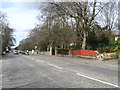
Heading in to Airdrie
The A89 at Drumgelloch.
Image: © James Denham
Taken: 20 Apr 2013
0.18 miles
7
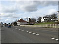
Looking west on the A89 at Clarkston
Heading for Airdrie.
Image: © James Denham
Taken: 20 Apr 2013
0.20 miles
8
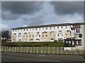
A block of flats at Clarkston
Near Airdire in North Lanarkshire.
Image: © James Denham
Taken: 20 Apr 2013
0.20 miles
9
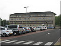
Flats on Katherine Street
Handy for Drumgelloch Station.
Image: © M J Richardson
Taken: 19 May 2014
0.20 miles
10
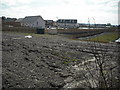
View to new estate
One of several phases of house building planned for the land belonging to the former Boots factory.
Image: © Jim Smillie
Taken: 18 Apr 2009
0.23 miles