
IMAGES TAKEN NEAR TO
Graham Street, AIRDRIE, ML6 6EF
Introduction
This page details the photographs taken nearby to Graham Street, ML6 6EF by members of the Geograph project.
The Geograph project started in 2005 with the aim of publishing, organising and preserving representative images for every square kilometre of Great Britain, Ireland and the Isle of Man.

There are currently over 7.5m images from over14,400 individuals and you can help contribute to the project by visiting https://www.geograph.org.uk
Image Map
Images are licensed for reuse under creativecommons.org/licenses/by-sa/2.0
Notes
- Clicking on the map will re-center to the selected point.
- The higher the marker number, the further away the image location is from the centre of the postcode.
Image Listing (30 Images Found)
Images are licensed for reuse under creativecommons.org/licenses/by-sa/2.0
Image
Details
Distance
1
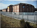
Supermarket service area
This was the South Nimmo St. entrance to Broomfield Park, home to Airdrieonians FC, which was sold in 1994.
Image: © Jim Smillie
Taken: 29 Mar 2009
0.02 miles
2
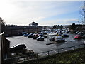
Morrisons supermarket and car park, Airdrie
Image: © Jonathan Thacker
Taken: 20 Feb 2020
0.04 miles
3
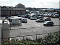
Supermarket car park
Sold to Safeway in 1994, Airdrieonians FC left Broomfield Park.
After 4 years ground sharing the Excelsior Stadium in the Craigneuk area of the town was opened. Image
Image: © Jim Smillie
Taken: 29 Mar 2009
0.05 miles
4
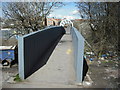
Footbridge over railway
This footbridge links Gartlea with South Nimmo St..
Image: © Jim Smillie
Taken: 29 Mar 2009
0.08 miles
6

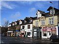
Airdrie from the air
The town centre is in the foreground. New Broomfield Park, home of Airdieonians FC https://www.airdriefc.com/ , is to the right of centre.
Image: © Thomas Nugent
Taken: 8 Dec 2017
0.10 miles
7
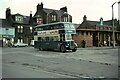
Baxter's bus, no.70, Airdrie Bus Station ? 1970
Baxter's ran a substantial network of town services in Airdrie until 1962 when the company was bought by Eastern Scottish, the main operator in the area. Initially buses were painted in standard Eastern Scottish green, but a local outcry saw a reversal of this, and the local identity was re-instated, eventually being phased out by 1977.
No.70 is a Leyland PD2/41, with lowbridge body by Massey Bros of Wigan, new in 1959, representing Baxter's standard vehicle through the 1950s. It also carried Eastern Scottish fleet number HH38.
The bus station site is now occupied by Airdrie Sheriff Court.
This is one of a series of views featuring buses in the 60s, 70s, and 80s.
http://www.geograph.org.uk/search.php?i=2114547&displayclass=slide
Image: © Alan Murray-Rust
Taken: 17 Sep 1970
0.12 miles
8
Three churches
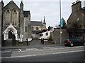
This shows the front of Airdrie Baptist Church with Flowerhill Church of Scotland behind to the right.
The spire belongs to St. Margarets RC Church.
Image: © Jim Smillie
Taken: 29 Mar 2009
0.13 miles
10

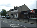
Old supermarket and office block
The old Somerfield supermarket and office block on Graham Street Airdrie will soon be no more as they are planned to be destroyed at the end of 2009.
Image: © Stevie Spiers
Taken: 12 May 2009
0.13 miles