
IMAGES TAKEN NEAR TO
Graham Street, AIRDRIE, ML6 6DB
Introduction
This page details the photographs taken nearby to Graham Street, ML6 6DB by members of the Geograph project.
The Geograph project started in 2005 with the aim of publishing, organising and preserving representative images for every square kilometre of Great Britain, Ireland and the Isle of Man.

There are currently over 7.5m images from over14,400 individuals and you can help contribute to the project by visiting https://www.geograph.org.uk
Image Map
Images are licensed for reuse under creativecommons.org/licenses/by-sa/2.0
Notes
- Clicking on the map will re-center to the selected point.
- The higher the marker number, the further away the image location is from the centre of the postcode.
Image Listing (119 Images Found)
Images are licensed for reuse under creativecommons.org/licenses/by-sa/2.0
Image
Details
Distance
1
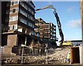
Demolition Site
A closer view of www.geograph.org.uk/photo/2174865
Image: © Texas Radio and The Big Beat
Taken: 23 Nov 2010
0.01 miles
2
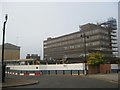
Old Fine Fare and DHSS, Airdrie (under demolition)
Stevie Spiers took a similar picture in May 2009 www.geograph.org.uk/photo/1300170
Progress has been slow - the demolition work appears to be being
done at a snails pace and more recently has almost ground to a halt.
These "carbuncles" will certainly not be missed!
For a picture of this demolition site late November 2010 click www.geograph.org.uk/photo/2174865
Image: © Texas Radio and The Big Beat
Taken: 3 Sep 2010
0.02 miles
3
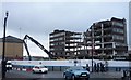
Old Fine Fare and DHSS, Airdrie (under demolition)
The old supermarket building has been demolished.
Work is now well under way demolishing the ugly office block.
See www.geograph.org.uk/photo/2091890 for picture in September 2010.
Image: © Texas Radio and The Big Beat
Taken: 22 Nov 2010
0.02 miles
4

Old supermarket and office block
The old Somerfield supermarket and office block on Graham Street Airdrie will soon be no more as they are planned to be destroyed at the end of 2009.
Image: © Stevie Spiers
Taken: 12 May 2009
0.03 miles
5
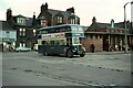
Baxter's bus, no.70, Airdrie Bus Station ? 1970
Baxter's ran a substantial network of town services in Airdrie until 1962 when the company was bought by Eastern Scottish, the main operator in the area. Initially buses were painted in standard Eastern Scottish green, but a local outcry saw a reversal of this, and the local identity was re-instated, eventually being phased out by 1977.
No.70 is a Leyland PD2/41, with lowbridge body by Massey Bros of Wigan, new in 1959, representing Baxter's standard vehicle through the 1950s. It also carried Eastern Scottish fleet number HH38.
The bus station site is now occupied by Airdrie Sheriff Court.
This is one of a series of views featuring buses in the 60s, 70s, and 80s.
http://www.geograph.org.uk/search.php?i=2114547&displayclass=slide
Image: © Alan Murray-Rust
Taken: 17 Sep 1970
0.06 miles
7
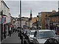
View across Airdrie town centre
From South Bridge Street.
Image: © Stephen Sweeney
Taken: 19 Mar 2014
0.08 miles
8
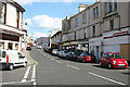
Hallcraig Street
Somewhere up there, but long ago demolished, stood the house where my great-grandmother was born in 1846. The remaining houses in this view were probably there when she was growing up, but she would barely recognise much of the town now..
Image: © Anne Burgess
Taken: 10 Jul 2014
0.08 miles
9
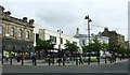
Airdrie Town Centre
Graham Street, viewed from Broomknoll Street.
Image: © Thomas Nugent
Taken: 25 Aug 2012
0.08 miles
10
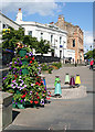
Graham Street
The line of frontages on Stirling Street and Graham Street widens out to make a central square, colourfully adorned with flowers and art works. The art work just beyond the floral display can actually be used as a series of stools.
Image: © Anne Burgess
Taken: 10 Jul 2014
0.09 miles