
IMAGES TAKEN NEAR TO
Brackenhirst Road, AIRDRIE, ML6 0PR
Introduction
This page details the photographs taken nearby to Brackenhirst Road, ML6 0PR by members of the Geograph project.
The Geograph project started in 2005 with the aim of publishing, organising and preserving representative images for every square kilometre of Great Britain, Ireland and the Isle of Man.

There are currently over 7.5m images from over14,400 individuals and you can help contribute to the project by visiting https://www.geograph.org.uk
Image Map
Images are licensed for reuse under creativecommons.org/licenses/by-sa/2.0
Notes
- Clicking on the map will re-center to the selected point.
- The higher the marker number, the further away the image location is from the centre of the postcode.
Image Listing (10 Images Found)
Images are licensed for reuse under creativecommons.org/licenses/by-sa/2.0
Image
Details
Distance
1

New Building near Drumbowie
I am not sure what the purpose of this building is; the rows of openings don't suggest that it is to be a house. See also Image]
Image: © Anne Burgess
Taken: 24 Aug 2013
0.04 miles
2
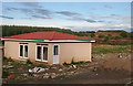
New Building near Drumbowie
This is just to the left of Image Again, I can't tell what it is intended for.
Image: © Anne Burgess
Taken: 24 Aug 2013
0.05 miles
3
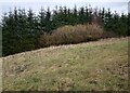
Signs of Spring
Catkins appearing on deciduous trees with darker conifers behind
Image: © Jim Smillie
Taken: 11 Feb 2023
0.18 miles
4
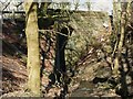
Shank Burn Bridge, Brackenhirst Road
Image: © Texas Radio and The Big Beat
Taken: 27 Mar 2010
0.21 miles
5
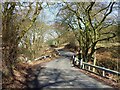
Shank Burn Bridge, Brackenhirst Road
Windy and narrow section of Brackenhirst Road where it crosses
the Shank Burn. See also www.geograph.org.uk/photo/1773338
Image: © Texas Radio and The Big Beat
Taken: 27 Mar 2010
0.21 miles
6
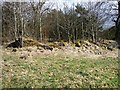
Ruined Cottage by Brackenhirst Road
This ruin is just above the west bank of the Shank Burn.
Old maps are not 100% clear as to its name. It was probably
called Merrybank Cottage but may have been called Nettlehole.
Image: © Texas Radio and The Big Beat
Taken: 27 Mar 2010
0.21 miles
7
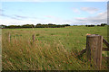
Field by the Brackenhirst Road
A fairly boring field, looking suitable only for grazing rather than arable.
Image: © Anne Burgess
Taken: 24 Aug 2013
0.22 miles
8
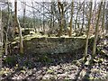
Ruined Cottage by Brackenhirst Road
See www.geograph.org.uk/photo/1773030 for more info.
Image: © Texas Radio and The Big Beat
Taken: 27 Mar 2010
0.23 miles
9

Bridge over the Shank Burn
At a double bend on the road about half way along Brackenhirst Road.
Image: © G Laird
Taken: 20 Jun 2012
0.23 miles
10
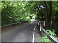
Brackenhirst Road crosses Shank Burn
Image: © Stephen Sweeney
Taken: 17 Jul 2013
0.24 miles