IMAGES TAKEN NEAR TO
Souter Gardens, COATBRIDGE, ML5 4SE
Introduction
This page details the photographs taken nearby to Souter Gardens, ML5 4SE by members of the Geograph project.
The Geograph project started in 2005 with the aim of publishing, organising and preserving representative images for every square kilometre of Great Britain, Ireland and the Isle of Man.

There are currently over 7.5m images from over14,400 individuals and you can help contribute to the project by visiting https://www.geograph.org.uk
Image Map (Loading...)


Getting Data...Please wait
Leaflet Map data © OpenStreetMap
Images are licensed for reuse under creativecommons.org/licenses/by-sa/2.0
Notes
- Clicking on the map will re-center to the selected point.
- The higher the marker number, the further away the image location is from the centre of the postcode.
Image Listing (12 Images Found)
Images are licensed for reuse under creativecommons.org/licenses/by-sa/2.0
Image
Details
Distance
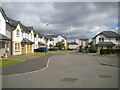
1
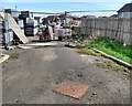
Houses under construction
On former industrial site
Image: © Jim Smillie
Taken: 23 Aug 2021
0.11 miles
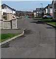
3
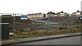
New road, Green End
A new road and its associated construction site. View from Paddock Street, Sikeside.
Image: © Richard Webb
Taken: 22 Jan 2010
0.13 miles
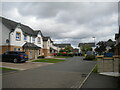
4
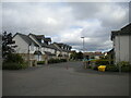
Pritchel Way, Whifflet
Seen from its rather complicated junction with Forgehill Crescent, Castings Avenue, and Bessemer Drive.
Image: © Richard Vince
Taken: 12 Sep 2022
0.16 miles
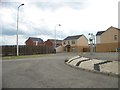
5
Next phase at end of street
Large housing development on former industrial site
Image: © Jim Smillie
Taken: 23 Aug 2021
0.16 miles
6
Helve Place, Whifflet
Off Forgehill Crescent.
Image: © Richard Vince
Taken: 12 Sep 2022
0.18 miles
7
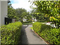
Footpath to Calder Street, Whifflet
Off Helve Place.
Image: © Richard Vince
Taken: 12 Sep 2022
0.18 miles
8
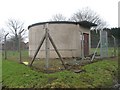
Pumping station, Sikeside
Water pumping station off Paddock Street.
Image: © Richard Webb
Taken: 22 Jan 2010
0.19 miles
9
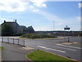
Calder Road roundabout
A roundabout on Calder Road.
Image: © Ross Watson
Taken: 27 Jul 2013
0.20 miles
10
Castings Avenue, Whifflet
Seen from its junction with Forgehill Crescent.
Image: © Richard Vince
Taken: 12 Sep 2022
0.21 miles