IMAGES TAKEN NEAR TO
Rothesay Crescent, COATBRIDGE, ML5 4JP
Introduction
This page details the photographs taken nearby to Rothesay Crescent, ML5 4JP by members of the Geograph project.
The Geograph project started in 2005 with the aim of publishing, organising and preserving representative images for every square kilometre of Great Britain, Ireland and the Isle of Man.

There are currently over 7.5m images from over14,400 individuals and you can help contribute to the project by visiting https://www.geograph.org.uk
Image Map
Images are licensed for reuse under creativecommons.org/licenses/by-sa/2.0
Notes
- Clicking on the map will re-center to the selected point.
- The higher the marker number, the further away the image location is from the centre of the postcode.
Image Listing (10 Images Found)
Images are licensed for reuse under creativecommons.org/licenses/by-sa/2.0
Image
Details
Distance
1
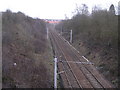
Railway near Rosehall, Coatbridge
Looking south east
Image: © Chris Upson
Taken: 26 Mar 2006
0.11 miles
2
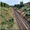
Part of Coatbridge-Motherwell railway
Eurocentral Rail Terminal is not far down this line
Image
Image: © Jim Smillie
Taken: 23 Aug 2021
0.15 miles
3
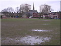
Waterlogged Football Pitch, Rosehall, Coatbridge
Image: © Chris Upson
Taken: 26 Mar 2006
0.15 miles
4
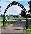
Whifflet Park
A multi-sports court has replaced tennis courts.
Fountain dates from 1880's
Image: © Jim Smillie
Taken: 23 Aug 2021
0.18 miles

6
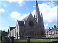
Calder Parish Church
A parish church on Calder Street.
Image: © Ross Watson
Taken: 27 Jul 2013
0.23 miles
7
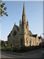
Calder Parish Church, Coatbridge
At the corner of Calder Street and Garturk Street.
Image: © G Laird
Taken: 15 Sep 2011
0.24 miles
8
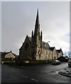
Calder Parish Church
Designed by Hugh H. MacLure 1870. http://portal.historicenvironment.scot/designation/LB23007
Image: © Jonathan Thacker
Taken: 20 Feb 2020
0.24 miles
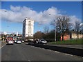
10
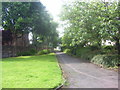
Whifflet Pathway
A pathway near Whifflet Street.
Image: © Ross Watson
Taken: 27 Jul 2013
0.24 miles