
IMAGES TAKEN NEAR TO
Miller Street, COATBRIDGE, ML5 3PG
Introduction
This page details the photographs taken nearby to Miller Street, ML5 3PG by members of the Geograph project.
The Geograph project started in 2005 with the aim of publishing, organising and preserving representative images for every square kilometre of Great Britain, Ireland and the Isle of Man.

There are currently over 7.5m images from over14,400 individuals and you can help contribute to the project by visiting https://www.geograph.org.uk
Image Map
Images are licensed for reuse under creativecommons.org/licenses/by-sa/2.0
Notes
- Clicking on the map will re-center to the selected point.
- The higher the marker number, the further away the image location is from the centre of the postcode.
Image Listing (45 Images Found)
Images are licensed for reuse under creativecommons.org/licenses/by-sa/2.0
Image
Details
Distance
1
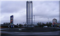
Roundabout at Whifflet Street
At the entrance to Faraday Retail Park. The lampposts appear to be having a "huddle".
Image: © Thomas Nugent
Taken: 5 Apr 2011
0.07 miles
2
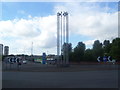
Roundabout Schulpture
A tall schulpture on Coatbank Street Roundabout.
Image: © Ross Watson
Taken: 27 Jul 2013
0.07 miles
3
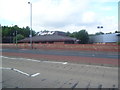
Pizza Hut Coatbridge
A Pizza Hut restaurant on Coatbank Street.
Image: © Ross Watson
Taken: 27 Jul 2013
0.07 miles
4
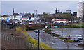
Faraday Retail Park
Pizza Hut, Tesco, KFC and Esso are some of the brand names on view in this photo which was taken from Whifflet railway station.
Image: © Thomas Nugent
Taken: 5 Apr 2011
0.10 miles
5
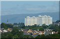
High Coats towerblocks
The cluster of three towerblocks appear as one when viewed from the two miles distant Eurocentral Junction 7 at the M8 motorway.
Image: © Thomas Nugent
Taken: 9 Aug 2020
0.12 miles
6
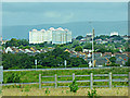
High Coats towerblocks
The cluster of three towerblocks appear as one when viewed from the two miles distant Eurocentral Junction 7 above the M8 motorway.
Image: © Thomas Nugent
Taken: 2 Aug 2020
0.12 miles
7
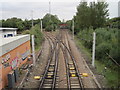
Whifflet Upper and Lower railway station (site), North Lanarkshire
Whifflet Upper was situated on the red bridge. It was opened as a single island platform in 1886 by the Rutherglen and Coatbridge Railway, soon to become part of the Caledonian Railway, and closed to passengers in 1964.
Beneath it, situated on either side of the tracks were the platforms of Whifflet Lower station, also Caledonian Railway. (Out of view to the right, the North British Railway also had a station from 1871 to 1930. No evidence of this appears to remain).
View north towards Coatbridge and Cumbernauld. The tracks diverging left lead to Glasgow Central via Carmyle.
Image: © Nigel Thompson
Taken: 12 Oct 2013
0.13 miles
8
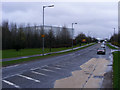
Caldeen Road
Looking into Caldeen Road from the pedestrian crossing near Whifflet Street roundabout.
Image: © Thomas Nugent
Taken: 5 Apr 2011
0.14 miles
9
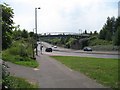
Coatbank Street
Looking southwards down Coatbank Street, a dual carriageway. The cycle route (NCN 75) runs over the road by the bridge.
Image: © Richard Webb
Taken: 25 Jul 2008
0.14 miles
10
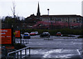
Whifflet railway station
Viewed across the B&Q car park from Caldeen Road.
Image: © Thomas Nugent
Taken: 5 Apr 2011
0.14 miles