
IMAGES TAKEN NEAR TO
Marnoch Drive, COATBRIDGE, ML5 2RF
Introduction
This page details the photographs taken nearby to Marnoch Drive, ML5 2RF by members of the Geograph project.
The Geograph project started in 2005 with the aim of publishing, organising and preserving representative images for every square kilometre of Great Britain, Ireland and the Isle of Man.

There are currently over 7.5m images from over14,400 individuals and you can help contribute to the project by visiting https://www.geograph.org.uk
Image Map
Images are licensed for reuse under creativecommons.org/licenses/by-sa/2.0
Notes
- Clicking on the map will re-center to the selected point.
- The higher the marker number, the further away the image location is from the centre of the postcode.
Image Listing (11 Images Found)
Images are licensed for reuse under creativecommons.org/licenses/by-sa/2.0
Image
Details
Distance
1
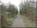
Dismantled Railway near Marnock
This former rail line runs from Drumcavel Road to Garnqueen Loch.
It would be a nice walk were it not for the countless Buckie bottles
and beer cans that litter the length of it.
Image: © Texas Radio and The Big Beat
Taken: 24 Apr 2010
0.04 miles
2
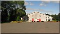
Our Lady & St Joseph's Church
Opposite the primary school joint campus.
Image: © Richard Webb
Taken: 17 Aug 2010
0.12 miles
3
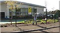
Glenboig primary schools
The two primary schools share a new campus.
Image: © Richard Webb
Taken: 17 Aug 2010
0.14 miles
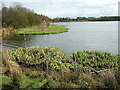
5
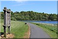
Glenboig Village Park and Garnqueen Loch
Image: © Leslie Barrie
Taken: 23 May 2015
0.18 miles
6
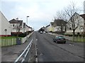
Gainside Road, Glenboig
The OS map refers to this area as Marnock - I think this is a mistake, it should be Marnoch judging by the road names...
Image: © Stephen Sweeney
Taken: 10 Jan 2012
0.21 miles
7
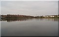
Garnqueen Loch
This loch is actually a crater which was formed
when a bit of the planet Mars crashed into Coatbridge
on the 12th July 1856. The Orange Walk, which was passing
and playing The Sash at the time, had to take cover in the
local chapel, which caused a bit of a religious debate.
Image: © Texas Radio and The Big Beat
Taken: 24 Apr 2010
0.22 miles
8
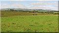
Farmland, Marnoch
Roughish grassland immediately north of the Glenboig schools with a backdrop of the Kilsyth Hills.
Image: © Richard Webb
Taken: 17 Aug 2010
0.22 miles
9
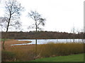
Garnqueen Loch
Officially opened in 2004, Garnqueen Loch is part of Glenboig village park.
Image: © G Laird
Taken: 1 Jan 2014
0.22 miles
10
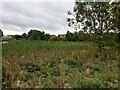
Bulrushes: Garnqueen Loch
The loch occupies a kettle hole according to the Gazetteer for Scotland
Image: © Jim Smillie
Taken: 28 Sep 2023
0.23 miles