IMAGES TAKEN NEAR TO
Annathill, COATBRIDGE, ML5 2QQ
Introduction
This page details the photographs taken nearby to ML5 2QQ by members of the Geograph project.
The Geograph project started in 2005 with the aim of publishing, organising and preserving representative images for every square kilometre of Great Britain, Ireland and the Isle of Man.

There are currently over 7.5m images from over14,400 individuals and you can help contribute to the project by visiting https://www.geograph.org.uk
Image Map (Loading...)


Getting Data...Please wait
Leaflet Map data © OpenStreetMap
Images are licensed for reuse under creativecommons.org/licenses/by-sa/2.0
Notes
- Clicking on the map will re-center to the selected point.
- The higher the marker number, the further away the image location is from the centre of the postcode.
Image Listing (14 Images Found)
Images are licensed for reuse under creativecommons.org/licenses/by-sa/2.0
Image
Details
Distance
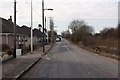
1
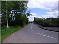
Annathill
View east along Mollinsburn Road.
Image: © Robert Murray
Taken: 28 Jun 2011
0.02 miles
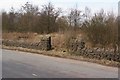
2
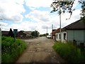
Annathill
At the beginning/end of the Right of Way. View south to part of the original village.
Image: © Robert Murray
Taken: 28 Jun 2011
0.04 miles
3
Annathill, Annathill Gardens
Rejuvenated former coal mining village.
See RCAHMS photos http://canmore.rcahms.gov.uk/en/site/176592/details/annathill+village/
and http://www.monklands.co.uk/annathill/index.htm for historical description and more photos.
Image: © Robert Murray
Taken: 28 Jun 2011
0.05 miles
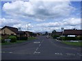
4
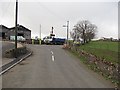
Annathill
Looking along Mollinsburn Road, the main road through the village of Annathill.
Image: © G Laird
Taken: 2 Jan 2014
0.06 miles
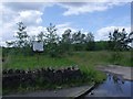
6
Old Entrance
Old maps only show the enclosed area as "recreation ground" and not long
ago it was also a travellers site. The area is now very overgrown.
Image: © Texas Radio and The Big Beat
Taken: 8 Mar 2010
0.12 miles
7
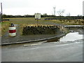
Annathill Travellers Site
The sign says this is a site for travelling people but access is a bit tricky.
Image: © Iain Thompson
Taken: 16 Apr 2006
0.16 miles
8
Annathill, derelict site
Built in 1985 for the travelling people it has been unused and derelict for a long time. See also Image from five years ago.
Image: © Robert Murray
Taken: 28 Jun 2011
0.17 miles
9
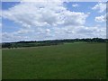
Annathill, pasture
View to south-east towards Gain.
Image: © Robert Murray
Taken: 28 Jun 2011
0.20 miles
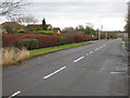
10
Roadworks, South Medrox
Looking along Gain Road.
Image: © Richard Webb
Taken: 20 Apr 2010
0.20 miles