1
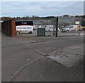
Works entrance
SGN (Scottish Gas Network) Coatbridge
Image: © Jim Smillie
Taken: 1 Apr 2022
0.08 miles
2
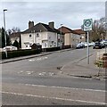
Chisholm Street
Typical inter war council housing
Image: © Jim Smillie
Taken: 1 Apr 2022
0.08 miles
3
Sunnyside, Coatbridge
The Sunnyside high flats, from Dunbeth.
Image: © Stephen Sweeney
Taken: 14 Feb 2012
0.17 miles
4
Room with a view
This shot was taken from my lounge the two tower blocks to the left of centre are located in Sunnyside, Coatbridge, Scotland. in the distance is Glasgow. i love this view from my lounge as the sky changes colour so often.
Image: © Stevie Spiers
Taken: 27 Sep 2007
0.17 miles
5
Coatbridge, West George Street
With smart high flats overlooking Sunnyside.
Image: © Robert Murray
Taken: 19 Oct 2010
0.19 miles
6
Coatbridge housing
Like most Central Scotland towns Coatbridge has a significant number of tower blocks built to replace slum terraces.
Image: © Jonathan Thacker
Taken: 20 Feb 2020
0.20 miles
7
Coatbridge College (Automotive & Transport)
Coatbridge College is on a number of sites around Coatbridge. This one is on Coltswood Road in Greenhill Industrial Estate.
Image: © G Laird
Taken: 4 Jan 2014
0.22 miles
8
Eastbound freight on Airdrie line at Greenside Junction east of Coatbridge Sunnyside
View westward, towards Coatbridge and Glasgow: former ex-NB Edinburgh - Bathgate - Glasgow line, now the electrified North Suburban line in from Airdrie. Struggling towards Airdrie a Class E freight is hauled by - a degraded? - Thompson B1 4-6-0 No. 61333 (built 7/48, withdrawn 12/62).
Image: © Ben Brooksbank
Taken: 5 Oct 1961
0.22 miles
9
Coltswood Cemetery
Coltswood Cemetery on Easter Sunday
Image: © Iain Thompson
Taken: 16 Apr 2006
0.23 miles
10
Kipps Locomotive Depot, near Airdrie
View westward, towards Coatbridge (Sunnyside) beside the Monklands lines to Slamannan and Causewayend etc. - which lost passenger services in 5/30, just east of the junction with ex-NB Glasgow - Coatbridge - Airdrie line, i.e. the eastern end of the present North Clydeside suburban system, soon to be extended to Bathgate. Kipps Depot (BR code 65E) provided some motive power for the suburban services but mainly locomotives for the various mineral lines of the area (including one or two cut down to fit under a very low bridge at Gartverrie). In 1954, the allocation was 49 locomotives (21 0-6-0s, 5 2-6-2Ts, 1 4-4-2T, 7 0-6-2Ts, 8 0-6-0Ts and 6 0-4-0Ts, also one ex-LMS (Caledonian) 0-6-0 Dock Tank). The allocation had fallen to 32 steam plus two Diesel shunters in 1961. (In this photograph, two of the J36 0-6-0s (Nos. 65241 and 65260) are visible by the coaler). The Depot closed to steam on 31/12/62, but continued to house Diesel locomotives until 6/11/67.
Image: © Ben Brooksbank
Taken: 5 Oct 1961
0.23 miles


