IMAGES TAKEN NEAR TO
Hamilcomb Road, BELLSHILL, ML4 2HG
Introduction
This page details the photographs taken nearby to Hamilcomb Road, ML4 2HG by members of the Geograph project.
The Geograph project started in 2005 with the aim of publishing, organising and preserving representative images for every square kilometre of Great Britain, Ireland and the Isle of Man.

There are currently over 7.5m images from over14,400 individuals and you can help contribute to the project by visiting https://www.geograph.org.uk
Image Map
Images are licensed for reuse under creativecommons.org/licenses/by-sa/2.0
Notes
- Clicking on the map will re-center to the selected point.
- The higher the marker number, the further away the image location is from the centre of the postcode.
Image Listing (9 Images Found)
Images are licensed for reuse under creativecommons.org/licenses/by-sa/2.0
Image
Details
Distance
1
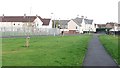
Open space, Babylon Road
Newly planted trees in a vulnerable location on a small bit of ground between Babylon Road and Babylon Avenue.
Image: © Richard Webb
Taken: 24 Oct 2011
0.10 miles
2
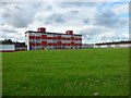
Lawmuir Primary School
In Bellshill.
Image: © Stephen Sweeney
Taken: 29 Jun 2011
0.11 miles
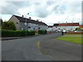
3
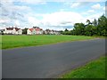
Southern edge of Bellshill
Community Road from Bothwellhaugh Road.
Image: © Stephen Sweeney
Taken: 29 Jun 2011
0.14 miles
4
Orbiston Pathway
Pathway by-passing Bellshill Golf Course.
Image: © Ross Watson
Taken: 15 Aug 2012
0.16 miles
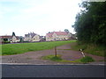
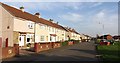
5
Kenmuiraid Place
Small dead end street in Orbiston, Bothwell.
Image: © Stephen Sweeney
Taken: 29 Jun 2011
0.19 miles
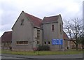
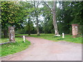
8
Liberty Road, Bellshill
On the left is the Liberty Community Church and behind the trees is the site of the old Bellshill Colliery Pit No.3 which was closed by 1935.
Image: © wrobison
Taken: 28 Nov 2020
0.24 miles
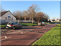
9
Cycle Path cut-through Bellshill Golf Course
The Greenlink Cycle Path cutting through Bellshill Golf Course.
Image: © Ross Watson
Taken: 13 Aug 2012
0.25 miles