
IMAGES TAKEN NEAR TO
Simpson Way, BELLSHILL, ML4 1TH
Introduction
This page details the photographs taken nearby to Simpson Way, ML4 1TH by members of the Geograph project.
The Geograph project started in 2005 with the aim of publishing, organising and preserving representative images for every square kilometre of Great Britain, Ireland and the Isle of Man.

There are currently over 7.5m images from over14,400 individuals and you can help contribute to the project by visiting https://www.geograph.org.uk
Image Map
Images are licensed for reuse under creativecommons.org/licenses/by-sa/2.0
Notes
- Clicking on the map will re-center to the selected point.
- The higher the marker number, the further away the image location is from the centre of the postcode.
Image Listing (7 Images Found)
Images are licensed for reuse under creativecommons.org/licenses/by-sa/2.0
Image
Details
Distance
1
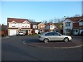
Cul-de-sac of Centenary Crescent
In Bellshill.
Image: © Stephen Sweeney
Taken: 18 Apr 2012
0.10 miles
2
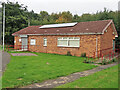
Community Hall in Clay Crescent, Bellshill
Part of the Clay Crescent Retirement Housing Complex.
Image: © wrobison
Taken: 23 Oct 2021
0.13 miles
5
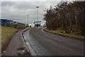
Reema Road
Looking to entrance of Mossend Railhead
Image: © Jim Smillie
Taken: 3 Feb 2023
0.20 miles
6

Shirrel Burn, Bellshill
Shirrel Burn runs through Shirrel, a council scheme in the North of Bellshill. Both the burn and the suburb are named after a big old farm that used to be pretty much all there was around here. It is shown as still being roofed on a 1968 Ordnance Survey map and was situated on the North side of Hattonrigg Road, roughly at the Ashgrove Road junction. These days planners like to give a nod to the past in street names, so 'Ashgrove' would probably be 'Old Farm' if built today. Back in the recent past, sadly, these things weren't a consideration.
Shirrell has lost its last 'l' somewhere along the line. But its spelling was already a matter of debate when the first 1850s map of here was published. Ordnance Survey went for the double, though mention in their accompanying naming book that it was commonly spelt with just one back then too. 'Shirle' was another option.
Although the shopping trolley has come apart a bit, it's always good to get the two classic pieces of river rubbish in one shot. The other being the bike of course.
Image: © Ian Dodds
Taken: 28 Feb 2026
0.21 miles
7
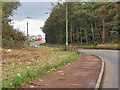
Reema Road, Bellshill
The access road to Mossend Railhead and Reema Road Industrial Estate.
Image: © wrobison
Taken: 23 Oct 2021
0.21 miles