IMAGES TAKEN NEAR TO
Westwood Road, WISHAW, ML2 9EJ

Introduction

This page details the photographs taken nearby to Westwood Road, ML2 9EJ by members of the Geograph project.

The Geograph project started in 2005 with the aim of publishing, organising and preserving representative images for every square kilometre of Great Britain, Ireland and the Isle of Man.

There are currently over 7.5m images from over14,400 individuals and you can help contribute to the project by visiting https://www.geograph.org.uk

Image Map


Images are licensed for reuse under creativecommons.org/licenses/by-sa/2.0
Notes
  • Clicking on the map will re-center to the selected point.
  • The higher the marker number, the further away the image location is from the centre of the postcode.

Image Listing (9 Images Found)

Images are licensed for reuse under creativecommons.org/licenses/by-sa/2.0
Image
Details
Distance
1
Burnt out car
Remains of a Lexus car burnt out by vandals on Guy Fawkes night.
Image: © dan m Taken: 6 Nov 2009
0.04 miles
2
Christmas day 2007 Kilmichael avenue Newmains
Kilmichael avenue Newmains looking toward Calder avenue . Taken Christmas day 2007 sun is out but it's still cold.
Image: © dan m Taken: 25 Dec 2007
0.08 miles
3
Looking to Eastwood Drive
Probably built as the property programmes describe as non-standard construction in the 1950's
Image: © Jim Smillie Taken: 25 Jun 2021
0.10 miles
4
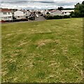
Landscaped bing near Newmains
Restored mine waste, now an informal park.
Image: © Richard Webb Taken: 16 Sep 2010
0.13 miles
5
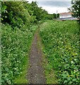
Path on old railway
Behind the houses on Kilmichael Avenue
Image: © Jim Smillie Taken: 25 Jun 2021
0.15 miles
6
Tiree Crescent, Newmains
Image: © Richard Webb Taken: 16 Sep 2010
0.21 miles
7
Shops, Newmains
Off Tiree Crescent.
Image: © Richard Webb Taken: 16 Sep 2010
0.22 miles
8
Newmains Community Advice Centre
Former shops.
Image: © Richard Webb Taken: 16 Sep 2010
0.24 miles
9
Housing at Newmains in North Lanarkshire
At the side of the A73.
Image: © James Denham Taken: 14 Sep 2013
0.24 miles