
IMAGES TAKEN NEAR TO
Burnhall Place, WISHAW, ML2 8EE
Introduction
This page details the photographs taken nearby to Burnhall Place, ML2 8EE by members of the Geograph project.
The Geograph project started in 2005 with the aim of publishing, organising and preserving representative images for every square kilometre of Great Britain, Ireland and the Isle of Man.

There are currently over 7.5m images from over14,400 individuals and you can help contribute to the project by visiting https://www.geograph.org.uk
Image Map
Images are licensed for reuse under creativecommons.org/licenses/by-sa/2.0
Notes
- Clicking on the map will re-center to the selected point.
- The higher the marker number, the further away the image location is from the centre of the postcode.
Image Listing (13 Images Found)
Images are licensed for reuse under creativecommons.org/licenses/by-sa/2.0
Image
Details
Distance
1

Snow and blue skies at Greenhead Moss
A path in the Community Nature Park at Greenhead Moss.
Image: © Alan O'Dowd
Taken: 12 Feb 2021
0.17 miles
2

Wintry day at Greenhead Moss
The snow had already turned to light rain as temperatures rose, but the hard-packed snow on the paths was still reasonably crisp.
Image: © Alan O'Dowd
Taken: 4 Dec 2020
0.17 miles
3

Autumn or winter?
A smattering of snow lies on the ground while some of the leaves remain on these trees in Craighead Moss Community Nature Park.
Image: © Alan O'Dowd
Taken: 28 Nov 2021
0.17 miles
4
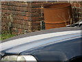
Ordnance Survey Flush Bracket S3031
This can be found on the wall of an out-building of house - private dwelling - at Waterloo.
For more detail see : http://www.bench-marks.org.uk/bm19341
Image: © Peter Wood
Taken: 15 Sep 2016
0.21 miles
5
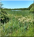
Marshy corner
The open water of Perchy Pond is some distance over the rushes and other marsh plants
Image: © Jim Smillie
Taken: 15 Jul 2021
0.21 miles
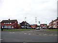
7
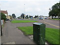
Roundabout at Waterloo allowing the A71 to cross the A721
Looking north-eastward from the A71.
Image: © Peter Wood
Taken: 15 Sep 2016
0.22 miles
8
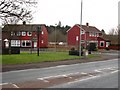
Bartonhall Road, Waterloo
Red Scandinavian style houses on Bartonhall Road off the A71.
Image: © Richard Webb
Taken: 11 Feb 2011
0.23 miles
9
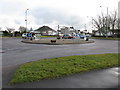
Roundabout at Waterloo
The intersection of the A71 and the A721. In the past there was no roundabout here, just a crossroads controlled by traffic lights.
Image: © G Laird
Taken: 16 Feb 2010
0.23 miles
10
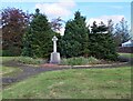
Waterloo War Memorial
A fairly recent memorial erected in 2006
Image: © Jim Smillie
Taken: 12 Oct 2023
0.23 miles