IMAGES TAKEN NEAR TO
Waverley Drive, WISHAW, ML2 7DR

Introduction

This page details the photographs taken nearby to Waverley Drive, ML2 7DR by members of the Geograph project.

The Geograph project started in 2005 with the aim of publishing, organising and preserving representative images for every square kilometre of Great Britain, Ireland and the Isle of Man.

There are currently over 7.5m images from over14,400 individuals and you can help contribute to the project by visiting https://www.geograph.org.uk

Image Map


Images are licensed for reuse under creativecommons.org/licenses/by-sa/2.0
Notes
  • Clicking on the map will re-center to the selected point.
  • The higher the marker number, the further away the image location is from the centre of the postcode.

Image Listing (8 Images Found)

Images are licensed for reuse under creativecommons.org/licenses/by-sa/2.0
Image
Details
Distance
1
Flats on Kirk Road
On the site of the former Wishaw Baths.
Image: © Ross Watson Taken: 15 Aug 2012
0.16 miles
2
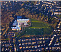
Coltness from the air
Coltness High School is pominent. See also Image
Image: © Thomas Nugent Taken: 8 Dec 2017
0.16 miles
3
Wishaw Morrisons
The Morrisons Supermarket in Wishaw, Kirk Road.
Image: © Ross Watson Taken: 15 Aug 2012
0.16 miles
4
Coltness High School from the air
Several games of football are in progress at the school, which is in a suburb of Wishaw.
Image: © Thomas Nugent Taken: 8 Dec 2017
0.21 miles
5
Waverley Drive
Part of a 1920s municipal housing scheme. Many of the houses are now owner-occupied, and demonstrate features typical of this - replacement windows and doors, added porches, varied colour-schemes. The streets are named on a 'Walter Scott' theme. Nearby there is Kenilworth Avenue, Lammermoor Terrace, Abbotsford Road and Crescent.
Image: © Anne Robertson Taken: 10 Oct 2007
0.22 miles
6
Mossland Drive
A residential street in Wishaw.
Image: © Richard Webb Taken: 11 Feb 2011
0.22 miles
7
St Aidan's High School
The main buildings of the roman catholic secondary school.
Image: © Ross Watson Taken: 15 Aug 2012
0.23 miles
8
Kenilworth Avenue one-way road
A one-way main road through forestry of Kenilworth Avenue.
Image: © Ross Watson Taken: 15 Aug 2012
0.25 miles