IMAGES TAKEN NEAR TO
Redwing Gardens, WISHAW, ML2 0JY
Introduction
This page details the photographs taken nearby to Redwing Gardens, ML2 0JY by members of the Geograph project.
The Geograph project started in 2005 with the aim of publishing, organising and preserving representative images for every square kilometre of Great Britain, Ireland and the Isle of Man.

There are currently over 7.5m images from over14,400 individuals and you can help contribute to the project by visiting https://www.geograph.org.uk
Image Map (Loading...)


Getting Data...Please wait
Leaflet Map data © OpenStreetMap
Images are licensed for reuse under creativecommons.org/licenses/by-sa/2.0
Notes
- Clicking on the map will re-center to the selected point.
- The higher the marker number, the further away the image location is from the centre of the postcode.
Image Listing (18 Images Found)
Images are licensed for reuse under creativecommons.org/licenses/by-sa/2.0
Image
Details
Distance
2
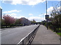
Caledonian Road
Caledonian Road in Pather, towards the West Coast Main Line railway bridge.
Image: © Ross Watson
Taken: 22 May 2013
0.04 miles
4
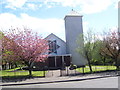
St. Thomas' Church
St. Thomas' Roman Catholic Church in Pather.
Image: © Ross Watson
Taken: 22 May 2013
0.07 miles
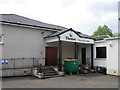
5

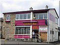
Abandoned Building
A dis-used building on Caledonian Road, Pather.
Image: © Ross Watson
Taken: 22 May 2013
0.07 miles
7
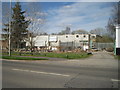
Wishaw (South) railway station (site), Lanarkshire
Opened c.1844 as "Wishaw" by the Wishaw and Coltness Railway on the line from Motherwell to Carstairs, this station became Wishaw South in 1880. It closed to passengers in 1958.
View north east from Netherton Road. The building in the left foreground behind the conifer is on the site of the old goods shed. The station was up on the embankment behind, just visible to the right of this building group.
Image: © Nigel Thompson
Taken: 15 Apr 2014
0.09 miles
8
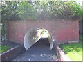
Pather tunnel
A tunnel under the West Coast Main Line railway bridge.
Image: © Ross Watson
Taken: 22 May 2013
0.10 miles
9
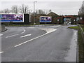
Road Junction on the B754 (near Gowkthrapple)
The B754 in the foreground as Castlehill Road continues to the left as Netherton Road, leading down to Motherwell.
Castlehill Road continues straight on as the B7032 and leads to Wishaw Cross.
The bridge on the B7032 carries the main south railway line from Glasgow to London.
Image: © G Laird
Taken: 15 Feb 2009
0.13 miles
10
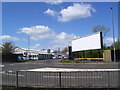
Advertisement Board
A large board at the Netherton Road roundabout.
Image: © Ross Watson
Taken: 22 May 2013
0.13 miles